Extra Credit is video series that examines topics related to history in the Thunder Bay District and exploring that history.
This episode, the seventh in sub-series on the former Kinghorn Subdivision, takes us to a chain of lakes just east of Wildgoose Lake. Here, the grade was built through two lakes, Ess and Porthos. Long, rock filled causeways highlight the journey, along with signage and the remains of the Milepost 28 water tank. *Apologies to the audio issues. My existing mics don’t seem to want to play nice with my new phone. Replacements are on the way and hopefully everything will be sorted out for the next episode.
Video of the former Canadian Northern Railway/CN-Kinghorn Subdivision (MP 45-49) at Jellicoe, ON. Features the grade east of and at Jellicoe, which was at one time a divisional point on the line with rock cuts and signage, some of it very old.
Video of the former Canadian Northern Railway/CN-Kinghorn Subdivision (MP 45-49) at Jellicoe, ON. Features the grade west of Zroback Station with ties and rock cuts.
Video of the former Canadian Northern Railway/CN-Kinghorn Subdivision (MP 45-49) at Jellicoe, ON. Features the grade as it crosses over a branch of the Namewaminikan River a long rock causeway, past Zroback Station with telegraph poles and rock cuts.
Video of the former Canadian Northern Railway/CN-Kinghorn Subdivision (MP 45-49) at Jellicoe, ON. Features the grade as it skirts a branch of the Namewaminikan River with cuttings, rock cuts and culverts.
Video of the former Canadian Northern Railway/CN-Kinghorn Subdivision (MP 45-49) at Jellicoe, ON. Features the grade west of Kinghorn Road with the remains of old logging spurs, telegraph poles and signage.
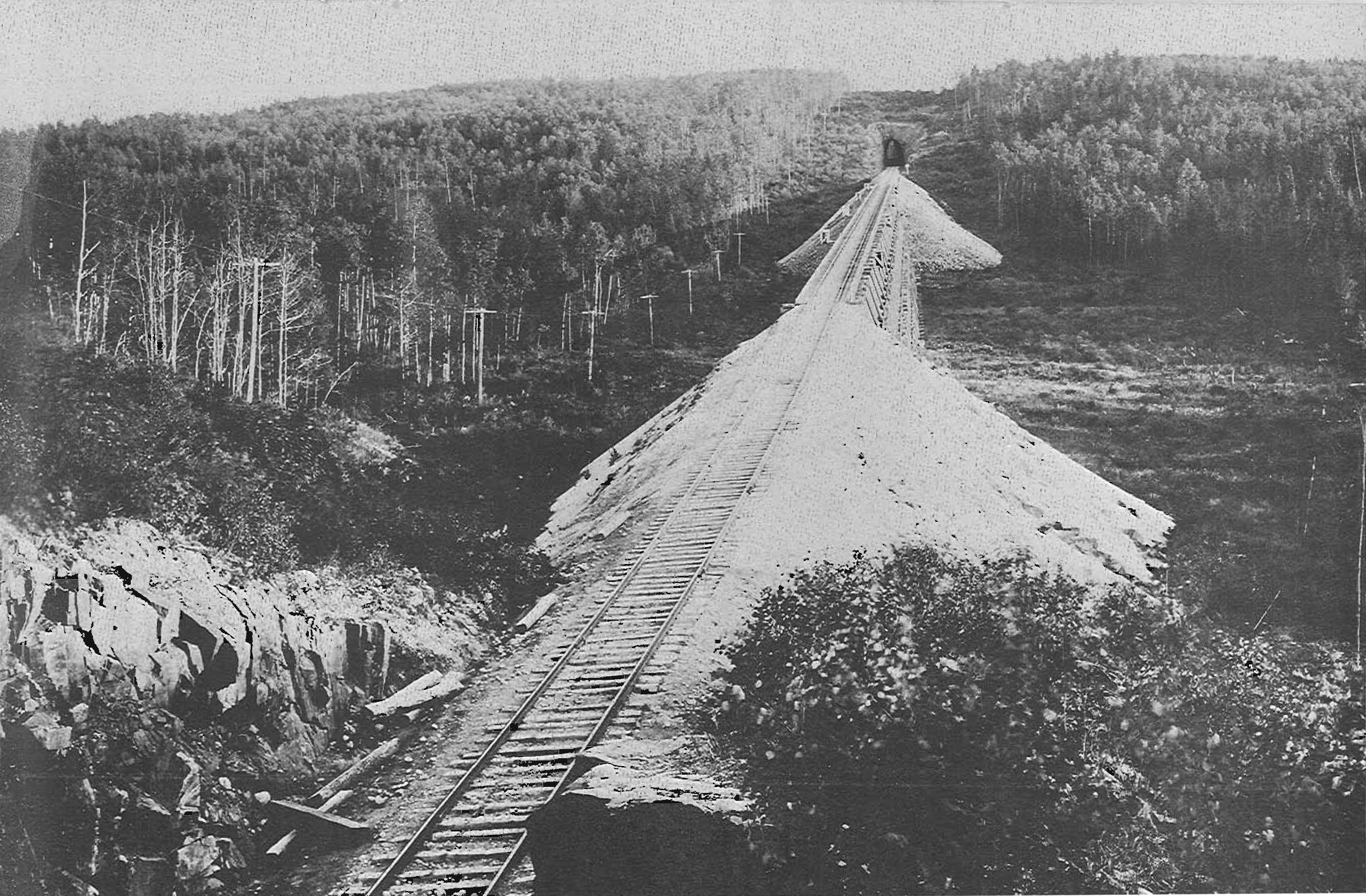
Video of the former Canadian Northern Railway/CN-Kinghorn Subdivision (MP 45-49) at Jellicoe, ON. Features the grade west of Kinghorn Road with cuttings, culverts and a former 132-foot trestle that filled in to create a large embankment in the early 1980s.
Extra Credit is video series that examines topics related to history in the Thunder Bay District and exploring that history.
Part of the experience of heading outdoors in getting there. This is part 3 of a multipart series on driving to our hiking destination. This episode was recorded in June 2024 and chronicles our journey to a multipurpose exploration we did near Wildgoose Lake in Greenstone. You can watch the other videos we did that day here: https://youtu.be/dOHPaf0uOJc
Extra Credit is video series that examines topics related to history in the Thunder Bay District and exploring that history.
In past episodes we have examined the use GPS in historical explorations and investigations. Recently I acquired a new GPS unit, a Garmin GPSMap 67i. In this third episode in the sub-series, I break down this latest offering from Garmin and how it differs from my old GPS, both good and bad. The technology has improved greatly over the years and I am really enjoying this new handheld.
On this day 30 years ago, Canadian National Railway is given permission by the Canadian Transportation Agency to abandoned its Graham Subdivision, which operated between Conmee Junction (northwest of Thunder Bay) and Superior Junction (east of Sioux Lookout) in northwestern Ontario.
This line was unique and had a very colourful history. It was constructed by the Grand Trunk Pacific Railway between 1905 and 1908 and was intended to provide access to Lake Superior for the Grand Trunk Pacific/National Transcontinental network. It was an anomaly as it was a GTP line, but connected to the NTR side of the transcontinental line and thus became intertwined in the story of multiple companies. In the early years, it went through a dizzying series of name changes:
1908 Grand Trunk Pacific Lake Superior Division
1915 Canadian Government Railways Fort William & Raith Subdivisions
1919 Canadian National Railways Fort William & Raith Subdivisions
1919 Canadian National Railways Lake Superior Subdivision (October)
1923 Canadian National Railways Graham Subdivision
1924 Canadian National Railways Crest & Graham Subdivisions
1925 Canadian National Railways Crest, Raith & Quorn Subdivisions
1926 Canadian National Railways Raith & Quorn Subdivisions
1931 Canadian National Railways Graham Subdivision
Although it saw considerable traffic at times in its history, business had declined considerably by the early 1990s. The last regular train ran in November 1992 and the line sat idle until the abandonment approval in May 1994.
Today the right of way is owned by Wagner Forest Management. One of the most popular sites for visitors is the Flett Tunnel, located a short distance west of Flett Station and approximately 50 kilometres northwest of Thunder Bay. The photos show the western portal of the tunnel in 1909 and 1996 respectively.
Flett Tunnel (west portal), 1909.Flett Tunnel (West Portal), 1996.