National Transcontinental Railway Hearst Subdivision
The National Transcontinental Railway Hearst Subdivision began in Hearst, Ontario and made its way 125.1 miles to Grant, Ontario.
Part of the National Transcontinental District 2, it was bounded on the east by the Cochrane Subdivision and on the west by the Grant Subdivision. A significant change for the line occurred in 1924. In an effort to consolidate its lines and produce a more efficient network, Canadian National Railways constructed a 30-mile section of track from Longuelac/Longlac on the former Canadian Northern Longlac Subdivision north to the NTR just east of Nakina Station on the Grant Subdivision. To facilitate this arrangement, Nakina Station was shifted west 3 miles and the divisional facilities at Grant were moved to Nakina, which added 19 miles to the line. The old site of Nakina became Shamokan Station, and the subdivision was renamed to the Pagwa Subdivision. Nakina was now the divisional point for both the Pagwa and the Caramat Subdivisions (the Caramat began in Hornpayne, Ontario).
After the realignment of lines, the Pagwa Subdivision became a secondary route with little through traffic. It survived mostly on logging and local business. As with most secondary routes, it received minimal and often deferred maintenance, including still using 80-pound jointed rail when other lines were using 100-pound jointed rails or 115 pound continuously welded rail. This limited the type and weight of locomotives and rolling stock that could be used on the subdivision. In 1986, CN announced that it would abandon the line and the rails were removed shortly thereafter. The section of track between Hearst and Calstock was purchased by Ontario Northland Railway (ONR) in 1993 and is still in operation today as part of a branch line running west from Cochrane, Ontario.
The stations and some of the notable locations on the line are listed below (mileage shown is per the original line):
| Milepost | Station, Siding or Point | Elevation (ft.) |
| 0 | Hearst | 807 |
| 1.12 | Hearst Junction (with Algoma Central Ry) | 807 |
| 5.92 | Ryland | 836 |
| 12.63 | Holland/Penhall* | 815 |
| 14.49 | Valentine Creek Bridge | 805 |
| 17.49 | Akova | 793 |
| 20.69 | Kabinakagami River | 818 |
| 22.39 | Kabina/Calstock* | 797 |
| 28.56 | Wapiti | 788 |
| 35.46 | Bertram | 746 |
| 38.85 | White/Shekak River Bridge | 721 |
| 39.47 | Skunk River Bridge | 719 |
| 40.6 | Nagagami River Bridge | 724 |
| 41.95 | Palmquist | 723 |
| 43.15 | Ameson | 772 |
| 49.85 | Nagagami/Pitopiko River Bridge | 750 |
| 50.05 | Nagogami/Nagagami* | 749 |
| 57.64 | Fraser | 689 |
| 58.24 | Bad/Otasawian River Bridge | 692 |
| 63.88 | Savoff | 679 |
| 64.78 | Savoff West | 670 |
| 70.52 | Teltaka | 625 |
| 75.82 | Pagwa River | 577 |
| 76.2 | Pagwachaun River Bridge | 566 |
| 77.8 | Pagwa Radar Base Spur | 610 |
| 78.42 | Pagwa | 617 |
| 85.01 | Wigwas/Wilgar* | 681 |
| 85.2 | Dog/Bicknell River Bridge | 682 |
| 93.42 | Flint/Flintdale* | 719 |
| 93.9 | Flint River Bridge | 719 |
| 98.69 | Kenoga/Ogaming/Blanche* | 799 |
| 101.89 | Kenogami River Bridge | 814 |
| 104.55 | Heidman/Ogahalla* | 852 |
| 110.03 | Watini/Lynx* | 893 |
| 116.6 | Carver/Jobrin* | 972 |
| 125.11 | Grant | 997 |
*Name changed **Added?
Timetables courtesy of J. Smith and Ingenium.
Maps
-
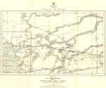
- BoM Kowkash Gold Area, 1915.
-
- DOI Hearst Sheet, 1918.
-

- DOI Lake Nipigon Sheet, 1917.
-
- Times Atlas, 1922.
-
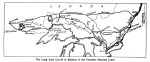
- Nakina Cut-off, 1923.
-
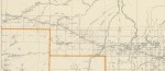
- DOI Hearst Sheet, 1928.
-
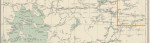
- DOI Lake Nipigon Sheet, 1927.
-
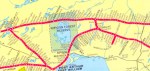
- CNR System Map, 1952.
-
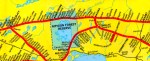
- CN System Map, 1965.
-
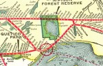
- CNR System Map, 1947.
Timetables and Stations
-

- Altitudes in Canada, 1915.
-
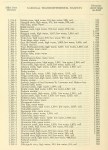
- Altitudes in Canada, 1915.
-

- CGR Hearst Subdivision, January 1916.
-

- CNR Pagwa Subdivision, November 1949.
-

- CNR Pagwa Subdivision, September 1951.
-
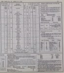
- CNR Pagwa Subdivision, April 1954.
-
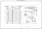
- CNR Pagwa Subdivision, September 1956.
-
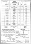
- CNR Pagwa Subdivision, June 1957.
-
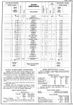
- CNR Pagwa Subdivision, December 1958.
-
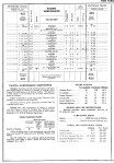
- CNR Pagwa Subdivision, April 1960.
-

- CN Pagwa Subdivision, June 1980.

