Don’t you just love when you know something is going to happen? I’m not really talking about déjà vu or anything like that, but just this sense that there is inevitability to a situation? We’ve all been there. In my case, it’s a ritual for this time of year…because it invariably happens every year. There’s always this glimmer of hope that maybe you’ve dodged the proverbial bullet for a change, but alas it is not meant to be. It’s been occurring now for such a long time that the only remedy to the situation is to change my patterns, which will not happen in the foreseeable future. So I guess I’ll just have to deal with it!
Well, it’s October kids. Is it just me, or does time go by faster the older you get? I can’t seem to keep up anymore. A month of school has blown by in a heartbeat. It was certainly tough to get back into the routine of work after being off for so long, but I guess it’s like riding a bike…18 years of experience also helps too! I am thoroughly back into the swing of things and boy is it insane. Every year I say it can’t get any worse and it seems like it does. Pretty soon it will just be time to have a heart attack and be done with it. Just kidding!
As usual, one of the main causes of my lunacy is football. It really has me burnt out…seriously! Ethan and Noah are both playing again this year and of course their schedules do not sync; I have not been home before 8:00 in weeks. When Ethan plays on Tuesdays, it is 10:00. As well, I am coaching Noah’s team and doing a lot more than I ever have, namely running the offense. I have never coach offense before in my life! Both of their teams are struggling a bit, but it’s more about the participation and experience than the wins and losses. The high school team is doing well, just having picked up our second win of the season. Before I know it, football will all be over and a distant memory.
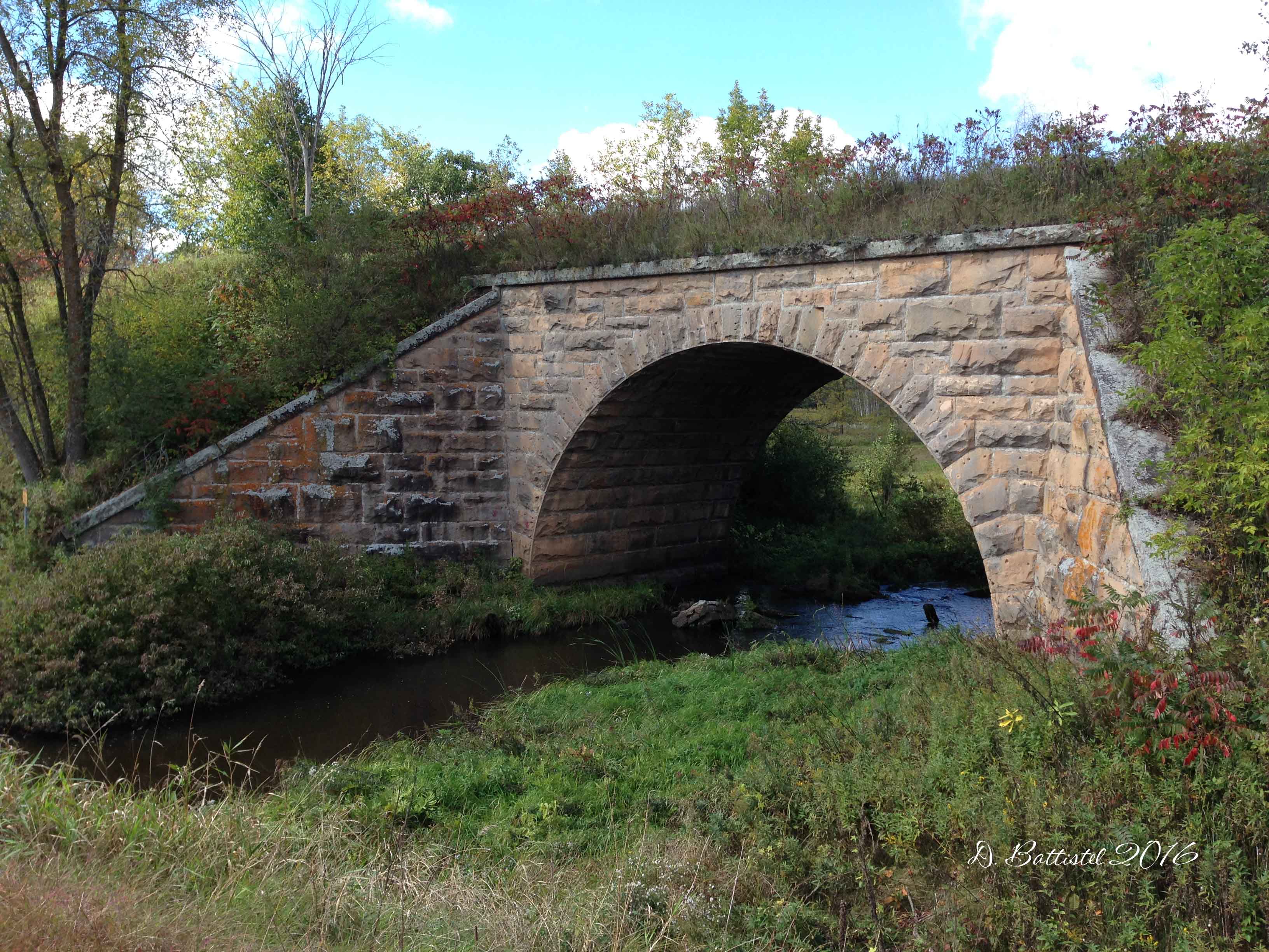
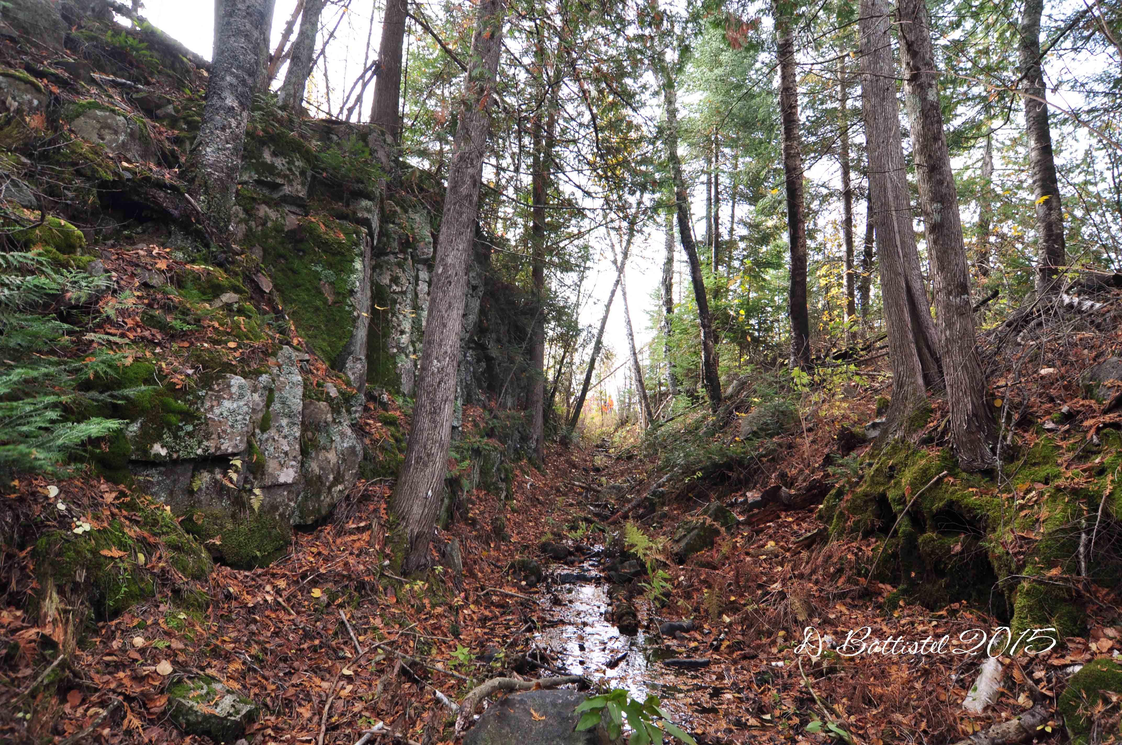
With all of this craziness I have not had any time to do any railway work, until now I guess. A few weeks back I travelled, on a rather psychotic timeframe I might add, to Saint Cloud, MN for the Northern Great Plains History Conference. I kinda of underestimated how far Saint Cloud is away. I left work at 1:30 (12:30cst) and drove pretty much straight for 6.5 hours. I met up with my co-presenter Lori for a few hours before heading off to bed. I woke up, did the presentation for a couple of hours (which went great), had lunch and then drove 6.5 hours home. I was a wee bit tired after all of that. Oh well, it was a great experience, and I was able to snap a few photos of a cool abandoned railway along the way!
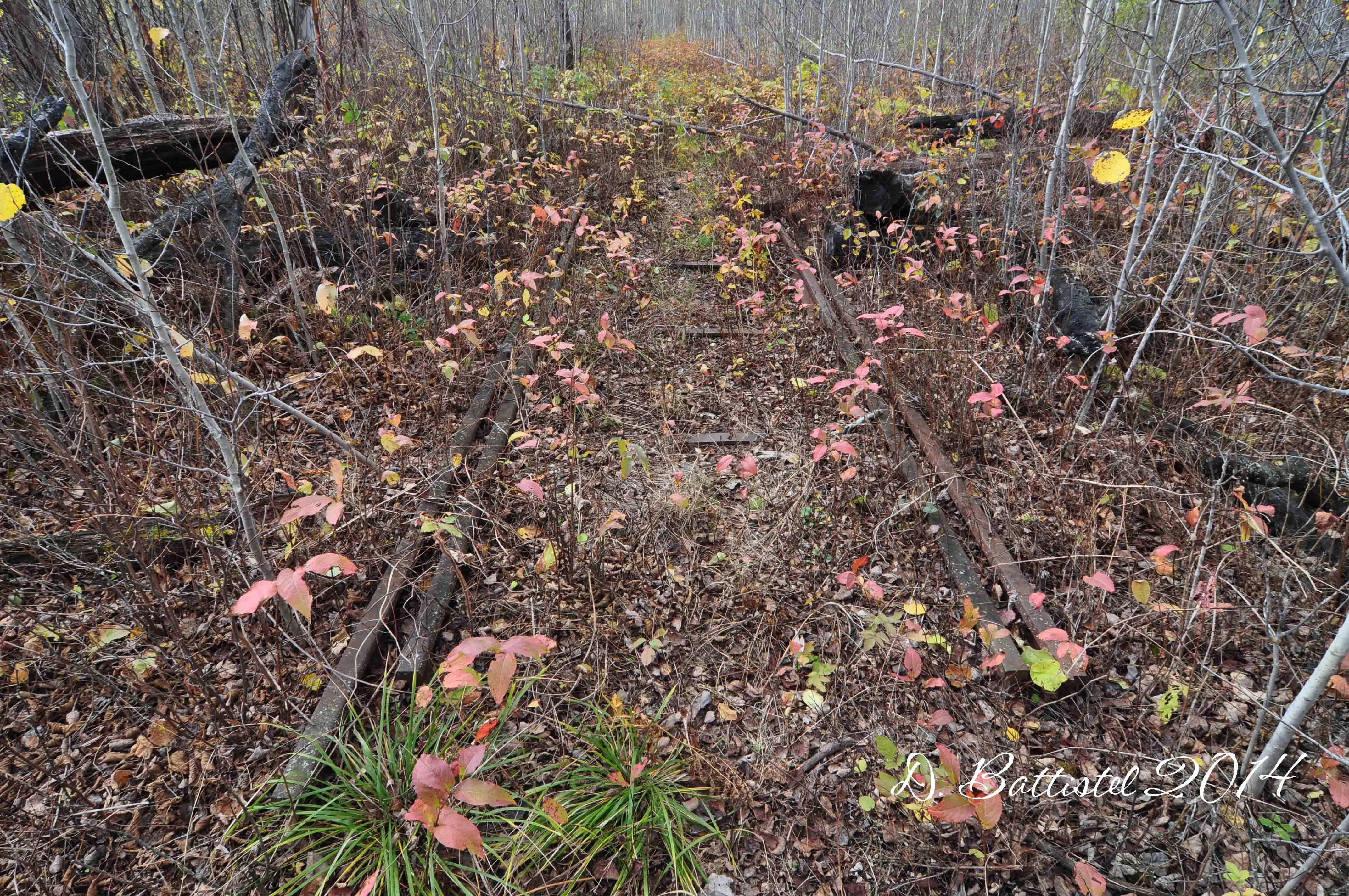
Great Northern RR stone bridge, South Fork, MN, September, 2016.
Great Northern RR, South Fork, MN, September, 2016.
Besides being burnt out, I can feel myself running down. Some form of the plague has been making the rounds at school and a lot kids have come down with it, including a good chunk of the football team. Right now I feel very tired and am bit stuffy, but it hasn’t yet developed into a full-blown cold. I pray that it doesn’t happen, but my luck isn’t usually that good. Guaranteed it will hit me at some point soon…I can’t wait.
So I’m currently in my room at the Cross River Lodge as it Canadian Thanksgiving weekend and as usual, I’m here at Gunflint for some field work. It’s always great to be here with the boys and visit with John and Rose. Besides, I really needed some time away from everything.
Now since I mentioned presentations, I actually just finished doing one. I arrived here this morning and unfortunately the weather was not very cooperative. It rained until about 10:00, and then it was really windy and cold, so I had to scratch today’s visit to the Gunflint & Lake Superior. Since I was just hanging around, John asked me if I wanted to do a little chat about the railway. I don’t really like to talk much, so it was a tough sell on his part (cue the eye roll). He made some phone calls and by 5:30 there was about 30-40 people assembled to listen to me ramble on about the PAD&W. For an impromptu affair, it went really well. The best part was that I received a fantastic gift; a photo of the railway at Gunflint Lake circa 1910 that I had been wanting to get for quite some time. It was a nice end to the evening.
The plan for tomorrow is to head across the lake to Bridal Falls and hike along a portion of the G&LS that I examined last year. I was not able to spend a lot of time along this section of the railroad, so hopefully I’ll be able to finish everything up and maybe find something interesting while I’m at it. My fingers are crossed that I won’t be too rough on the lake; the wind was pretty wicked today.
Anyway, I better get to bed. I’ll be back as soon as I can with a full recap of the trip and my discoveries. Until then…
No, I didn’t walk 500 miles, but I did wear boots…rubber boots that is. I did walk like a man, but definitely not like an Egyptian. It was very hot outside, so I may have well been walking on the sun. It wasn’t after midnight, and I definitely did not walk in a line. See what I’m doing here? Do ya? I know you do.
I’m back kids! I’m sounding a little chipper right now, but if you’ve looked at a calendar lately you’ll know that this isn’t a great time of the year. Yup, it’s almost time to go back to work. Sigh. We can’t stop time, so it is inevitable that the end of August comes around. I’ve already started back into parts of the routine; going in to work, prepping for football, getting materials ready, yada, yada, yada. I’m exhausted after two days and I’m not even officially back…it’s going to be a rough start-up.
I just returned from a family vacation the other day and I’m still in that “I need a vacation from the vacation mode,” which might explain why I feel tired. Jo-Anne and I took the boys to Minneapolis and Wisconsin Dells. In Minnie we made our first visit to Valleyfair, which was great, but not quite the same as Wonderland. The boys enjoyed all the attractions, especially the coasters; dad, not so much.
The second part of the trip took us to the The Dells for the first time. The “Water Park Capital” certainly has a lot of waterparks. We got our fill of water rides, coasters and go carts. The boys’ favourite spot was definitely the wave pool at Mount Olympus called “Poseidon’s Rage.” Every two minutes a gigantic wave comes rolling through the pool; we positioned ourselves at the 3 foot level where the wave would break, pummel us with water and send us flying backward. We spent hours in there and I may have left with a slight concussion.
So since I was away for a bit, I haven’t had railway time lately. However, I did manage to get some in before our trip south of the border. If you remember, I had a presentation scheduled at the Chik-Wauk Museum for August 14th. This was going to be my first full-length lecture on the Gunflint & Lake Superior Railroad, so I was pretty excited. It went well, but the turn out was a bit disappointing. Unfortunately there were several other events coinciding with it that contributed to the lack of bodies in the seats. The good news is that I’m going to be back there next summer with the same presentation and hopefully a bigger audience.
Because I had to go there for the presentation, I decided that I would take the opportunity to do some field work at Gunflint. I booked a night with John and Rose at the Cross River Lodge so we could hike the next day before heading home. What would be different for this hike was the fact that I had a larger entourage; in addition to the boys, my wife joined us as well (with a lot of prodding). I was hopefully going to trace the route of the G&LS along the north shore of Crab Lake, if luck was on my side.
After a nice ride across the lake, we beached the boat south of Bridal Falls. From there we walked to the top of the falls, about 700 metres, which was made a little more difficult by a number of trees knocked down on the trail by recent storms. There we split up, with Jo-Anne and the boys continuing east along the Border Route Trail for 1500 metres to where it intersects with the Crab Lake Trail. They would then take the latter trail south for 900 metres and await my arrival.
In the meantime, I would follow parts of the railroad grade south for 800 metres until I reached Crab Lake. From there, the meeting point at the east end of the lake was more than a kilometre away, the temperature was climbing and there was not a stitch of wind. I had no idea how difficult the walk would be and what the bush looked like.
Turns out, it was quite the mess. The last time I walked the railroad grade in the summer it nearly killed me (not literally)…this time was pretty close. The tall grass made it very difficult to see where you were stepping and there was a lot to trip over. The area was burned by the 2007 Ham Lake Fire and there was already a ton of deadfall on ground. Recent storms pushed many dead, burned trees over, making some areas a nightmare to negotiate.
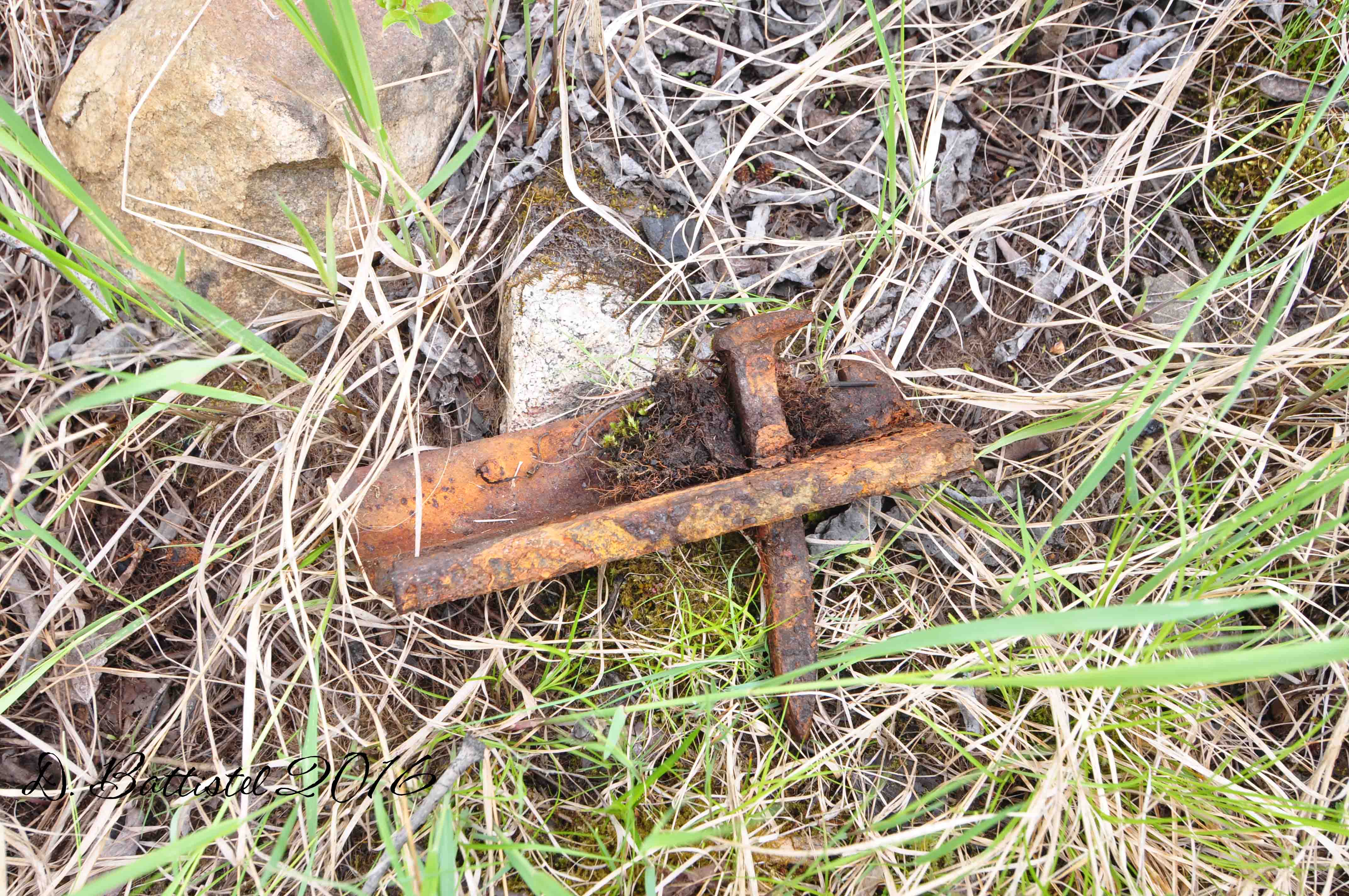
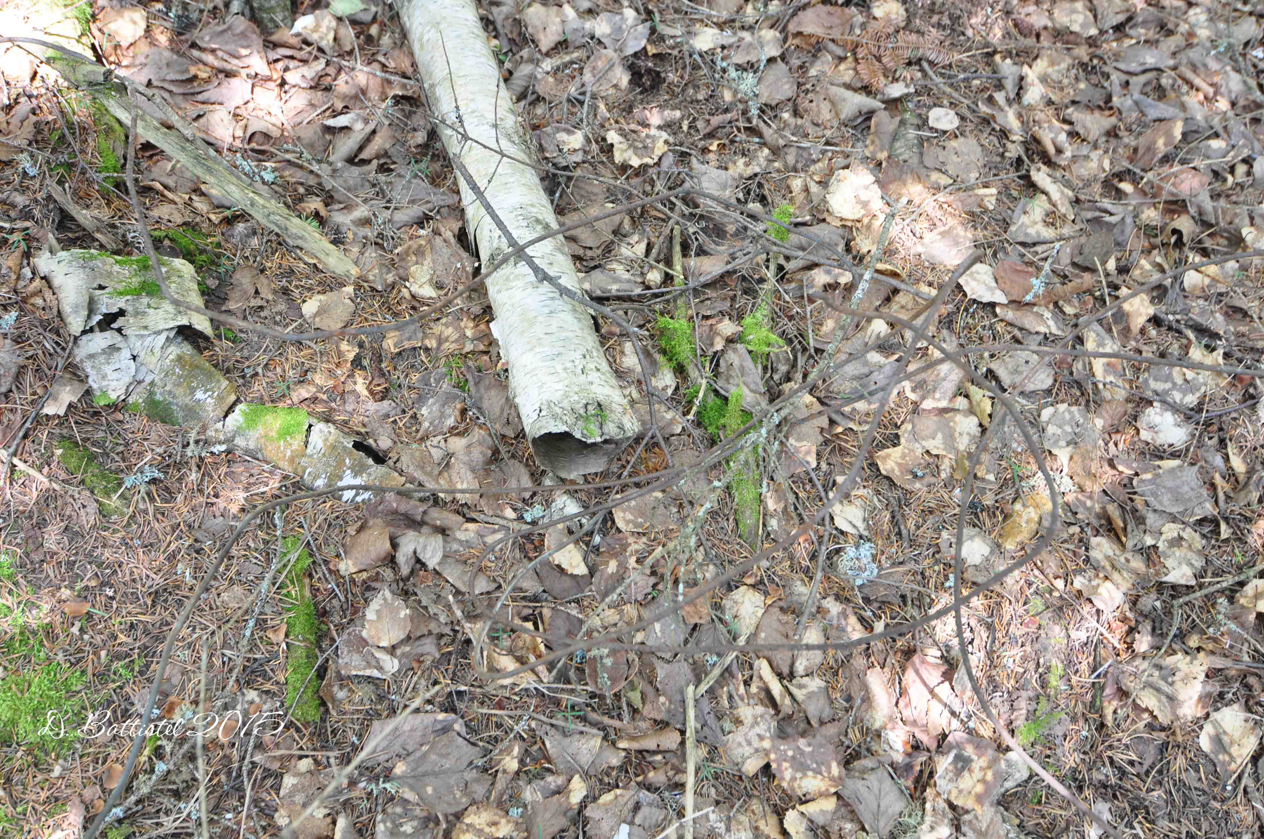
Thankfully I had success in my goal of following the grade. I did find several spikes and one fishplate along the way, as well as a few examples of rock work beside the lake. There were a few spots where I could not find any traces, but in general I was able to get the route down. I did cut the hike a bit short at the east end of the lake as I was completely exhausted and I could literally feel my hamstrings tightening up on me (walking over all the deadfall tends to do that). I’ll have to try and get that part done at some other time, maybe next year.
Railroad grade along Crab Lake, August 2016.
Spike at Crab Lake, August 2016.
Railroad grade along Crab Lake, August 2016.
Fishplate at Crab Lake, August 2016.
Railroad grade along Crab Lake, August 2016.
Railroad grade along Crab Lake, August 2016.
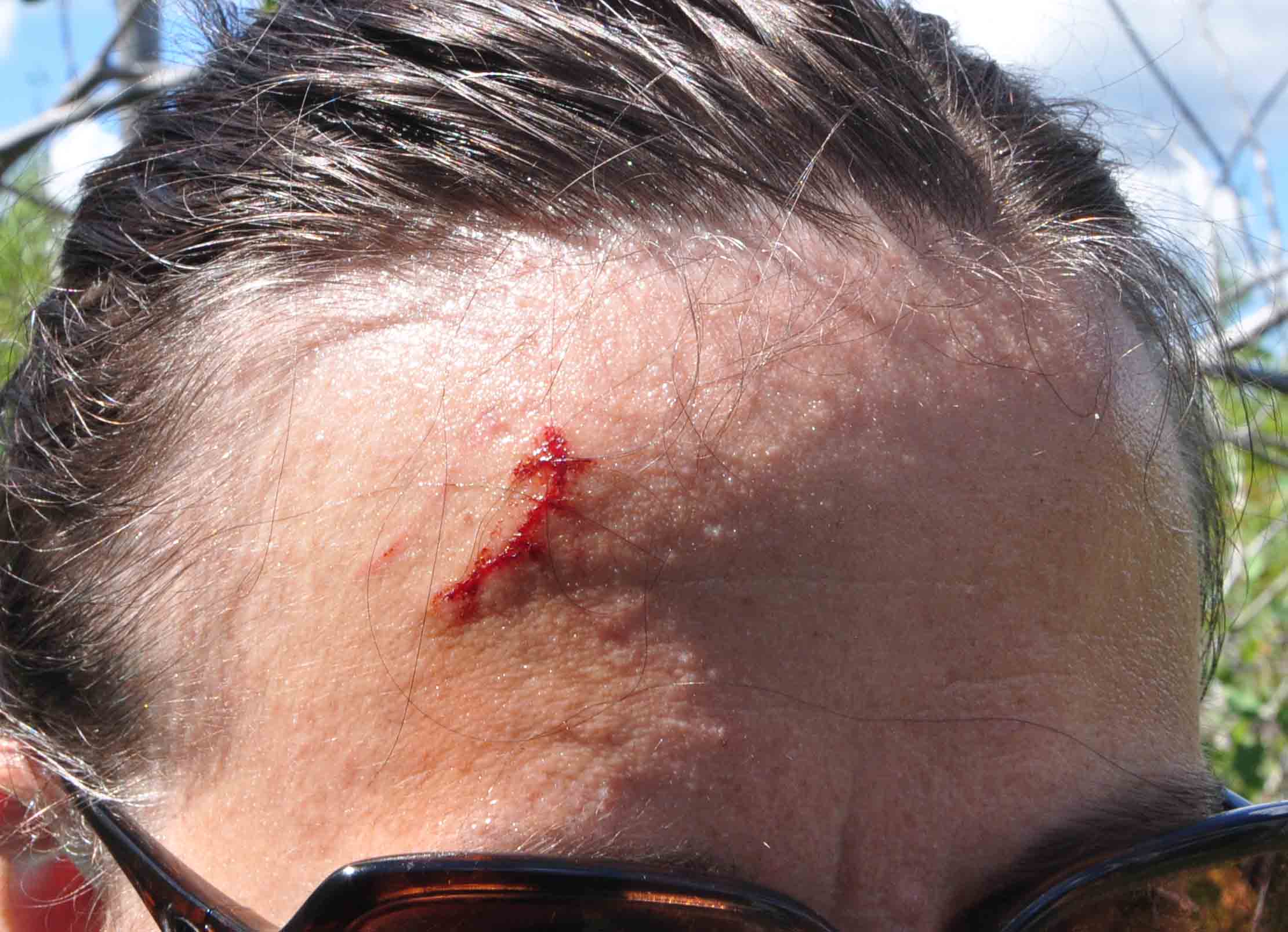
I had kept in radio contact with the family the entire way, so they were waiting for me when I was done. At our reunion, I was greeted by the sight of my wife with a large, bloody gash on her forehead. Apparently she had an unfortunate encounter with a dead tree branch, earning herself a nice cut, or better yet, a “battlescar.” Hey, did I mention that battlescar was my nickname when I was in the army reserves? Obviously a play on my last name, I thought it was an appropriate term for her boo boo.
Hiking injury, August 2016.
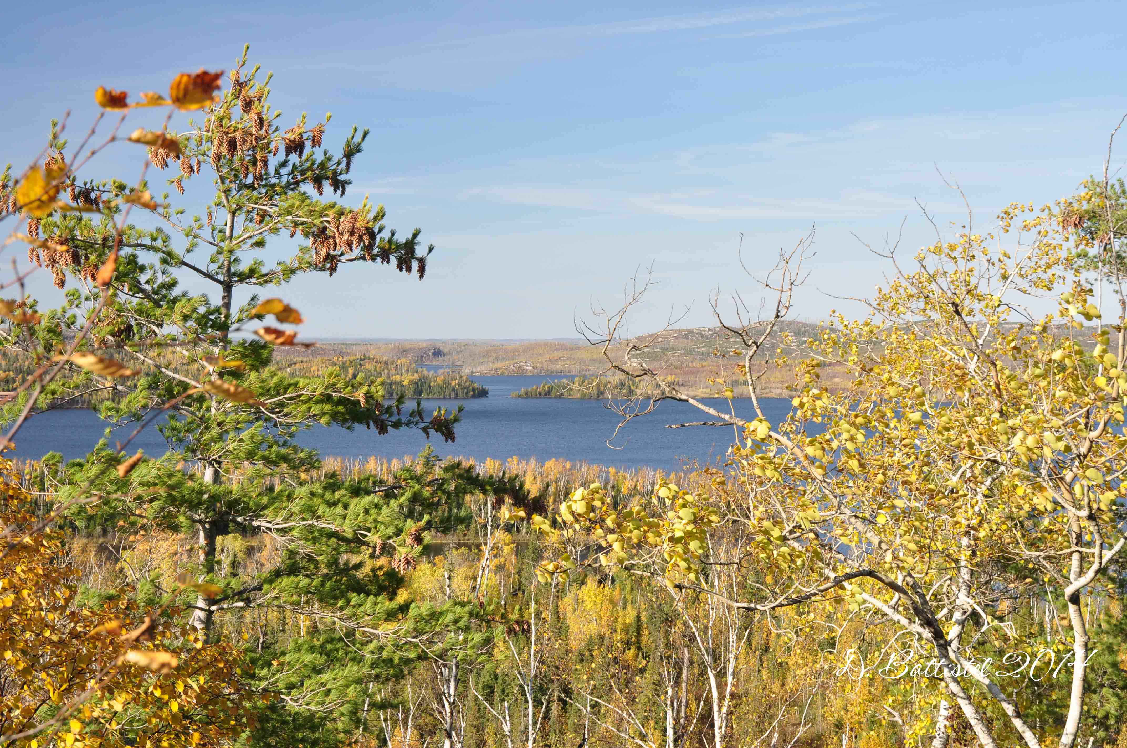
The walk back was tough as we battled through the stifling 31C heat. However it was compensated by the beautiful panorama that we passed beside on the trail. It would be great to visit that spot in the fall as the leaves changed colour; I’ll have to keep this in mind for the future. It was a very productive hike and I am excited to get back to Gunflint in October for another round of field work.
Panorama of Gunflint and North Lakes, August 2016.
My next big event to look forward to is the Northern Great Plains History Coneference in St. Cloud, MN on September 17th. I think I’m ready, but my brain so isn’t there right now…too much school stuff to think about. I am sure I’ll be good to go when the time comes, but it all adds to my anxiety. It is going to be a quick trip as well; I leave after school on Friday for the six hour drive to St. Cloud. Hopefully I don’t get in too late, because the presentation is at 9am (cst) after which I need to head back home. What a whirlwind visit!
Anyway, I better go. Way to many things to do right now. I’ll be back in the near future, probably after the trip to St. Cloud. Until then…
Did you know that I was a famous columnist at one time? Well, maybe famous is a bit of an over-exaggeration; let’s say well known. Okay, maybe that’s a stretch too, but I’m sure at least a few people read my work. So, what paper did you write for Dave? Globe and Mail? National Post? New York Times? Ummm, not quite. Chronicle-Journal? Unfortunately not. Try the Lakehead University Argus. Come again? Yup, you read it right; I wrote a weekly column at my alma mater, Lakehead, during my final year of university. See, I told you I was famous! The name of said column…you guessed it, Dave’s Outdoor Adventures. I was outdoorsy and a writer even way back then! For even more nostalgia, I was going to call this post “Episode II: Electric Boogaloo” (how many of you can remember that far back to know what I’m talking about?).
Well, here we are in June…the leave is almost over (yes, I am not counting July and August since that is normal time off). It’s kind of sad. Unfortunately all good things must come to an end. As I’ve mentioned on several occasions already, I have made the time count though. I’ve managed to get a lot done around the house and now my focus is going to shift to camp, that is when I get back from my trip.
June means a return to football, even though I am on sabbatical. I spent two lunch hours last week speaking first to Grade 9s at St. Pats and then to Grade 8s at Pope John Paul (our feeder school) about our program. In preparation for that, I was stuck to the computer for several days putting together this year’s edition of our recruiting video. Next year I need to make sure I start it well ahead of time so it’s not such a rush!
In the final few days in May I did manage to get out for my second hike of the year, probably the last for a bit until I get things taken care of at camp. My plan was to repeat a hike I had done last year, this time with a better plan and a secondary agenda. My journey would take me to Crab Lake, via the Border Route Trail access spur near Loon Lake.
It’s about a 3km hike from where you park to the trail intersection between Crab and Whisker Lakes. First, I was going to try and locate portions of the grade of the Gunflint and Lake Superior Railroad and determine if in fact it had come as far as the eastern end of Crab Lake and continued on along Whisker Lake. In 2015 I had focussed my search along a road that had been put in during the late 1920s or early 1930s (possibly on top of the railroad grade) and is now part of the hiking trail.
Crab Lake trail, May 2016.
Crab Lake, May 2016.
Whisker Lake, May 2016.
I knew from my search last year that this one time road did not look right, especially as there were too many undulations, even for a logging railroad. I swept it for about 300 metres in an eastward direction, finally determining that there was nothing to be found. I had always suspected that the grade was along the shore of the lake and with the lake drier than last year, I decided to take a look.
Within 40 metres I had found what I was looking for, actually quite by chance. My metal detector picked up a “hit,” but it was coming back at around 7 inches below the ground; from past experience I knew that any traces of the railroad tend to be closer to the surface, usually within an inch or so. Turns out, the location was above a small overturned stump. When I looked underneath it, I made the big discovery-a spike sitting right there. I had located the grade. From that point I made my way east along the shore for about 200 metres, finding more spikes and even a piece of fishplate in the process. Later I found more spikes, another fishplate and some coal near the west end of the lake.
Spike, May 2016.
G&LS grade, May 2016.
Spike and fishplate, May 2016.
Coal, May 2016.
The other part of the trip involved trying to locate a second logging camp belonging to the Pigeon River Lumber Company. I found documentation pointing to the existence of this camp back in March, and I was given a rough idea of where I could look from a spot discovered by Superior National Forest archaeologist Lee Johnson in 2007.
While I will not reveal the exact location, I did find the remains of what could have been a logging camp more than 100 years ago. The site was littered with tin cans of all types, and the best evidence, from my perspective anyway, was the discovery of several small barrel hoops. This leads me to believe that this was probably an early 20th century site as wooden barrels would have not been used in the 1930s. I also turned up a few nails a short distance away. An exact confirmation is pending; I have another location I want to check out next year to make sure I’m as close to sure as I can be.
Cans, May 2016.
Cans and barrel hoops, May 2016.
So I am writing this from a hotel in La Crosse, Wisconsin, which means that I am on the first leg of my long-awaited research trip to the US. I’ll be spending a few days here in La Crosse before moving on to Chicago. I don’t have as much to do there, so my wife and I will be spending most of our time in the Windy City being tourists.
It’s almost 8 hours from Thunder Bay to La Crosse, and since we had to leave after noon due to a previous commitment, we got here in the evening. The drive down was quite interesting. Everything was fine until we passed Grand Marais; then we were subjected to short, periodic bursts of torrential rain, so hard at times it was difficult to see the road. Then as we approached Two Harbors, we received a severe thunderstorm warning for the Duluth-Superior area. Apparently there were winds reported up to 60 miles per hour and a potential for damaging hail. Thankfully none of that appeared.
The last time I drove through parts of Wisconsin it was 1977 and I was 3 years old…so it’s been a while. I rather enjoyed the scenery, as it is quite different than I am accustomed to in Northern Ontario. We managed to make really good time on the Interstate between Superior and Eau Claire. Along the way, I spotted some really nice rail-trail paralleling parts of I-53. It made me think a lot about the PAD&W and how it’s a shame that there are not more parts of it that have become trail. However, it has been nearly 80 years since it’s abandonment and in many places there is way too much infrastructure to repair to make it viable.
After a stop for some food in Rice Lake, we proceeded to Eau Claire where we left the Interstate for Highway 93, which winds its way 130km from there to La Crosse. I found this part the most intriguing, for it really gives you a glimpse of rural America. And besides, the rolling hills, farms and deciduous forests were well worth the 55mph speed limit. Too bad we won’t be passing back through it on our way to Chicago.
Highway 93 near Arcadia, WI, June 2016.
Anyway, I better get rolling. I’m off to the archives soon. I’ll have a full debrief of the trip when I return home. Until then…
Really? You must be a lucky guy Dave! I know…I was pretty excited about it myself; I haven’t done it this often in a long time. It was worth all the money, time, exertion and effort too. I know what you’re thinking…is he really talking about this on his blog? Isn’t that a tad inappropriate? Money? Isn’t this a family blog? Well, of course it is…what is it that you think I’m talking about? Oh, I know, you’re confused. Well, that never happens here right?
So we’re here at the end of October and I am totally out of gas. It has been a crazy fall! Between everything that has gone on in my family life and work, I am very surprised I am still alive. No really…I’m not joking. It is a huge struggle to keep my head above water and I feel like I am not on the ball when it comes to teaching. I am behind in my marking and my planning isn’t as sharp as it usually is; I’m not focussed. I really need that sabbatical.
Football is winding down for another year. Noah and his Alouette teammates played in the TBMFA Atom championship on last Saturday and came away 25-6 winners. He played well in the victory, recording several tackles at his outside linebacker position. This week was the start of playoffs in high school junior football, and after finishing third in the standings we took on Superior in the quarterfinals on Thursday. It was a tough 20-6 win and we now move on to play Hammarskjold next week. I am very proud of this group as they have come along way since the beginning of the year and they have accomplished a lot no matter what happens from here.
Speaking of busy, this month has been very active for me on the railway front. On the 4th the historical society held its annual History Day at the Silver Mountain Station. This year’s edition had a very special guest, Harold Alanen, who was launching his new book, “They Came From All Around.” This was of great interest to me, since I’ve worked with Harold at Gunflint Lake in the past and his book covers a lot of history associated with the railway. I look forward to finish reading his book once things calm down.
Since I already brought it up, let’s talk about Gunflint. The weekend after History Day was Thanksgiving here in Canada and as I’ve done for the past few years, I spent it in Minnesota with the boys. It is some great father-son time, but also an opportunity to get field work done with most of the leaves down and the ground fairly dry.
Our adventure started bright and early on Friday morning as we packed up and made our way to the Cross River Lodge. After a short stop in Grand Marais for provisions, we arrived at the lodge by 9:30 or so. It was nice to catch up with John and Rose…it’s become like a second home for me. Shortly after noon we were heading across a very rough lake for the 11km ride to the site of Camp 4.
My objective for the day was pretty minimal, with just some minor explorations of the area. I did find a few interesting things, but no major breakthroughs for the time being. On the way back we took a short detour to Gunflint Narrows since the water on the lake was very low (not extreme, but one of the lowest I’ve seen). The boys climbed around on the rocks while I photographed the remains of the railway trestle.
Gunflint Narrows, October 2015.
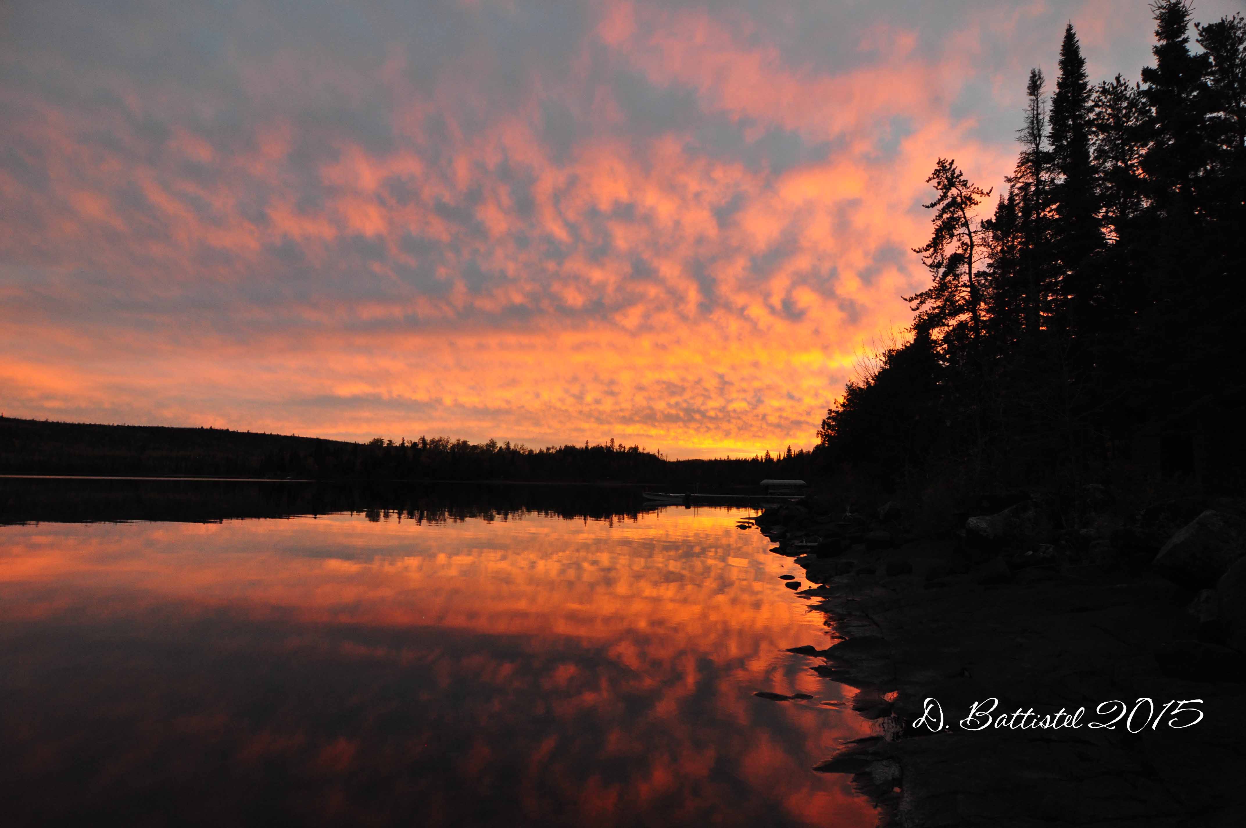
One of the highlights of our trip was the spectacular evenings we experienced. The winds were very calm, the lake like glass and the sunsets were amazing. After the difficult times we’ve had over the past little while, I felt like it was some great therapy for the boys and myself. I really hope it repeats itself when we are there next year!
Sunset, Gunflint Lake, October 2015.
Sunset, Gunflint Lake, October 2015.
Sunset, Gunflint Lake, October 2015.
Sunset, Gunflint Lake, October 2015.
Saturday was expected to be the big day. My goal was to travel across the lake again, this time to the site of Bridal Falls, and explore the Gunflint & Lake Superior Railroad south toward Crab Lake. I had done this last year, but this time I had a better plan and hoped for better results. Armed with my metal detector (which I had bought specifically for this purpose), I hoped I would find some physical traces of the line and determine its exact route to Crab Lake.
After a much nicer ride on the lake in the cool fall air, we made our way up past Bridal Falls and on to the railroad right of way. My first big surprise was the state of the grade; last year it had been completely flooded by a beaver dam on the Crab River right at the top of the ridge. To my surprise the water was gone! I didn’t bother checking to see if it was a result of the dam being broken, but I really didn’t care…it made my life much easier!
The line was easy to follow in this area, with corduroyed logs very visible under the grade. Half way across the 180m stretch we made our first find-a small spike (one of the smallest I’ve ever seen), which told us we were on the right path. Continuing southward we entered a wooded area and immediately found another spike, keeping us pointed in the right direction. But this was all to be expected; it was further south that the route of the line was in question. After 140m, we reached another low, open section.
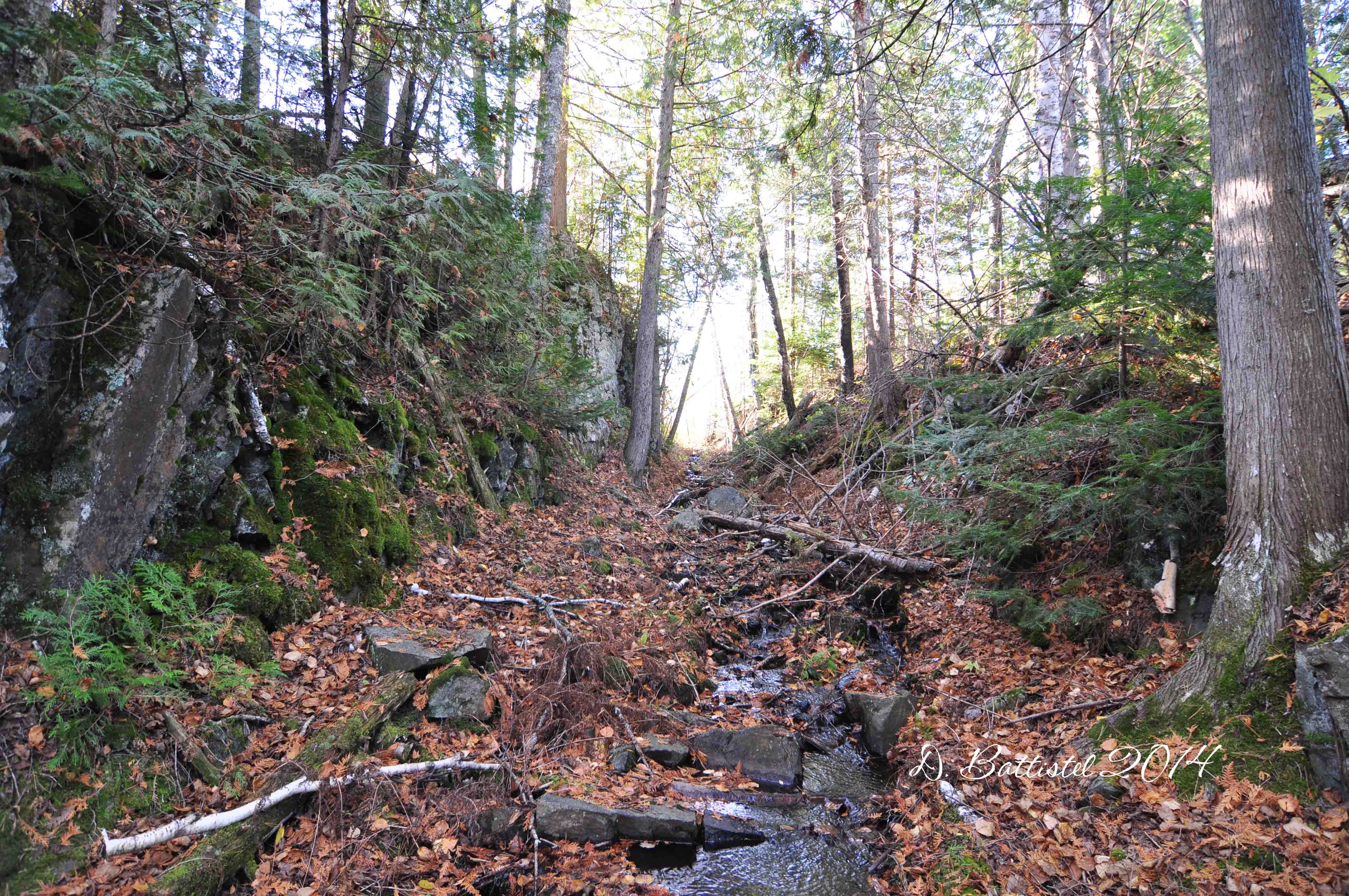
G&LS rock cut, October 2015.
G&LS grade, October 2015.
Corduroyed logs, October 2015.
Last year it was here that I lost the line, but not this time. It didn’t take me long to find a spike, which told me my hunch was right, that the grade followed the course of the river. I crossed the low area and came into a wooded section where I immediately found yet another spike. As the grade curved around this ridge, I began finding many traces of the line. I came across a railway related object (might be part of a switch) and then several fishplates and spikes. The grade was clearly cut into the ridge as it swung from a south-westerly to southerly to south-easterly direction. Another fishplate told me I was still on the right “track.”
Switch part?, October 2015.
G&LS cutting, October 2015.
G&LS fishplate, October 2015.
As the grade turns easterly the river widens to form a small lake, and the railway curves along the shore of the lake. Last year I found corduroyed logs in the water in several places in this 300m stretch. This time around I turned up a metal object at the northern apex of the lake and then several spikes at the southern end where the lake narrows again. A short 150m walk took me down to Crab Lake, finding more spikes along the way. While the boys took a break on the shore, I followed what turned out to be the grade a short distance confirmed by yet more spikes. There’s still another kilometre to explore to the east end of Crab Lake, which I hope to get to next year.
G&LS Grade, October 2015.
On the walk back to the boat we stopped to take some photos of the beautiful Bridal Falls. The trip back to the lodge was much nicer than the previous day and it felt good to have a shower and relax. It was a tough day of hiking so I decided to treat the boys to dinner at the Gunflint Lodge. This has become a tradition for us on these trips and it’s a great opportunity for us to just hang out.
Crab River, October 2015.
Bridal Falls, October 2015.
Bridal Falls, October 2015.
Bridal Falls, October 2015.
Bridal Falls, October 2015.
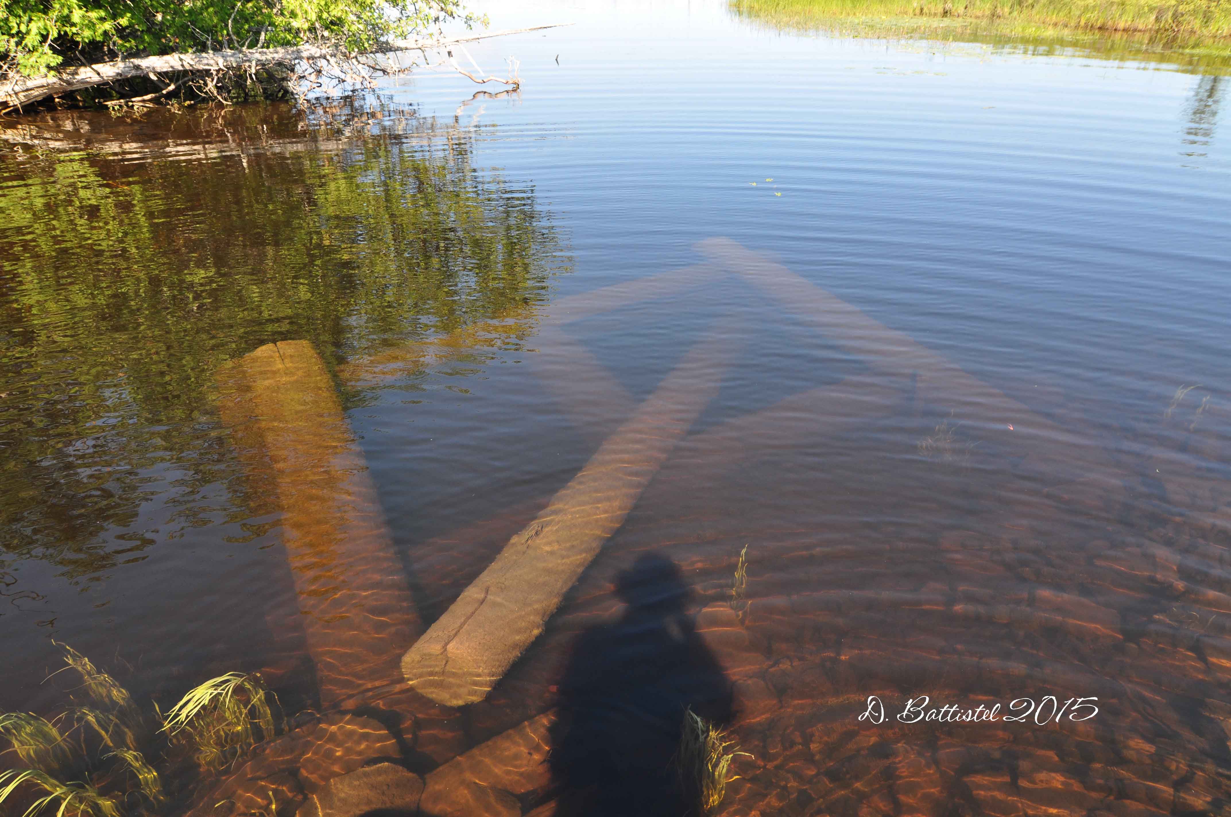
Sunday dawned bright and sunny again and after breakfast we were off across the lake for our last hike. I didn’t expect this one to yield any great breakthroughs since it was a section I had walked last summer. Our starting point was going to be where the railroad crossed a small creek 700m south of the boundary. With the water low, I was forced to paddle the boat in the last hundred metres to the shore. The remnants of the bridge were very visible in the water and I spent some time photographing them before proceeding ashore.
Bridge remains, October 2015.
Bridge remains, October 2015.
It did not take us very long to follow the grade as it winds its way along the lake up to the narrows separating Little Gunflint and Gunflint Lakes. After stopping a little while, we made our way back south. Things that I had previous seen along this stretch were much more visible, such as the corduroyed logs underneath the grade. With the leaves down, it was easier to follow the line and photograph its features.
G&LS grade, October 2015.
Rail, October 2015.
Corduroyed logs, October 2015.
G&LS cutting, October 2015.
Bridge remains, October 2015.
Our last night at the lodge was another great one. The mercury that day had risen to an unheard of level; the thermometer at the lodge was showing 91F, or 32C! It was gorgeous barbequing supper on the deck of the lodge and then enjoying the very warm evening. The next morning we were up early and after breakfast we had to sadly bid farewell to John and Rose and Gunflint Lake. I booked next year’s trip while I was there, so the countdown is already on to Thanksgiving 2016!
So, I guess after all of this blabbering I should mention something about the title. Well, one of things that came up during our time at Gunflint was the fact that I had not been hunting in a long time-eleven years to be exact-and that the boys had never been before. Hunting was a part of my youth. My dad hunted, not avidly, but rather I think he just enjoyed being outdoors and walking (I wonder where I get it from). I have some very fond memories of those times and I want the boys to experience that too.
The plan was that the following Sunday, if the weather cooperated, we would head down to North Lake to do some hunting and explore the railway at the same time. I had not walked this portion of the PAD&W since 2010 (I think) so I would be an opportunity to kill two birds with one stone, if you pardon the pun. It would also be the first time in a long time that I did field work twice in a week!
We left early for the 100km or so drive down to the lake. Once we parked the truck we started on the long walk, almost 7km, toward our destination at Trestle Bay. Luck was on our side again and it was shaping up to be another fantastic day.
PAD&W embankment, October 2015.
After about a kilometre of walking, we came across our first ruffled grouse, or partridge as we call them around here. I was a little nervous about actually shooting, as it had been such a long time since I had last fired a gun. Thankfully, my aim was true with my dad’s old Mossberg .410 and we bagged our first bird of the day. Unfortunately the shotgun blast scared the bejesus out of poor Noah!
This trip was a bit of nostalgia for me. Way back in the fall of 1990 I made my first trip to North Lake; I was all of 16 years old and it was also my first time moose hunting. Friends of the family had just purchased the former Bishop’s homestead on the lake and I was taken by all the history in the area. Walking the grade, finding spikes and exploring the remains of the North Lake Station really captured my imagination. This is where it all began.
PAD&W rock cut, October 2015.
Back then the grade was only clear for one kilometre past the property where it crossed a swamp. I had a lot of success in those days finding birds along this stretch and luck was on my side once more; by the time we reached the swamp we already had 3 of them. Continuing on we netted our limit by the time we arrived at the site of Greer’s logging camp, some 2.5km to the west (5 shots, 5 birds). The gun was then unloaded and shouldered, the dog cut loose and I could now concentrate on walking the grade. The hike was so picturesque and relaxing; I had forgotten how beautiful this area was. I also came to the realization that while enjoyed the time hunting, I’d much rather be focussing on the railway.
PAD&W cutting, October 2015.
PAD&W cutting, October 2015.
PAD&W rock cut, October 2015.
Greer’s logging camp, October 2015.
PAD&W rock cut, October 2015.
PAD&W rock cut, October 2015.
By noon we reached Trestle Bay, and after a break for some food we started back toward the truck. We paused several times along the way to take some video of the many rock cuts in the area. We arrived at our starting point around 3:30, just in time to get rolling home, but not before we cleaned the partridge. I don’t think the boys enjoyed that part very much, but neither did I when I was their age. It did feel good to share this icky part with them though, especially teaching them how to do it properly just as my dad did with me. I think that he would have been proud of the day we spent together…hopefully we can do it all again next year.
Trestle Bay, October 2015.
Well, I think I’ve said enough for now. This post has taken a lot of time to write and put together…twice in a week is more exhausting than I thought. Anywho, I better go; more news and info coming soon. Until then…
Step 1: Find some hiking gear. Preferably something you’re not concerned about breaking or wrecking. Make sure you have sunscreen and especially bug dope…don’t want the bugs to eat you alive.
Step 2: Get yourself up to the woods in northwestern Ontario/northeastern Minnesota. There are roads and in some cases airports nearby. It might take some time, but you’ll enjoy the scenery.
Step 3: Find an old abandoned railway and start calling out for me, kind of like Hansel and Gretel. I’m sure to turn up; I’m the one wearing the desert camouflage hat, gps in hand and toting camera gear.
Step 4: Now follow me as I hike along the overgrown grade looking for something old and historical, or maybe just seeing where the trail goes. It will be scorching hot and you’ll get scratched up and probably fall a bunch of times. It’s okay though, as all those things add character (and scars and bruises), and besides, before you know it, you won’t know where you are. Don’t worry though, we have a gps.
Et viola! Getting lost in four easy steps. I think I should turn this into a book or maybe an infomercial.
You should already know that I have a pretension for being facetious and flare for overdramatizing things. Obviously this is another one of those instances. However, the title of this post is based on real events and real people…names have been changed to protect people’s identities. Sorry, couldn’t resist! Seriously though, I did almost get a little lost on my recent trip, maybe. I know, I know. I’ll explain it all later.
We’ve now entered the fourth week of summer vacation (I actually started this post while I was sitting and looking out at Gunflint Lake on a beautiful evening). Time certainly flies! It’s been all good though, as vacations generally are. It’s just hard to believe we’re almost through the month of July, and that means there is only one month left before its back to work. But we’ll just forget about that part.
So other than that little blip of two weeks ago (you know, the big downpour around Hymers and Nolalu), the weather has been pretty good. It’s been pretty dry and warm. This past weekend was probably the best all summer, with temperatures hovering around 30C. We just came home from camp, where we’ve been since Saturday. It was nice to be able to jump in the lake to cool off and the boys certainly enjoyed everything that camp brings with it.
Bass Lake, July 2015.
Alright, so let’s get to the whole point of the article shall we. The big event that I have been building up to over the last little while (well, really since I found out about this in February) finally arrived. I was very excited for a four day trip to Gunflint Lake to participate in an archaeological exploration of the former Pigeon River Lumber Company logging camp at the east end of the lake. The trip would also give me an opportunity to take a look a few things that were of importance to my research.
I departed bright and early on Tuesday morning, knowing that the sooner I left, the sooner I would get to Gunflint. By 9:30cst I was at the Cross River Lodge and catching up on things with John and Rose. Shortly thereafter I had stowed my stuff in my room, put the boat in the water and was heading across the lake for my first hike. The objective for the day was to beach the boat on Little Gunflint Lake and see if I could locate telegraph poles and possibly insulators along the PAD&W all the way to the junction of the Gunflint & Lake Superior.
My first challenge of the day would be the lake. The previous few days had been windy and Tuesday was no exception. I have already mentioned on several occasions how interesting boating on Gunflint Lake is when it is windy. I certainly had my work cut out for me. Compounding things was the fact that the wind was blowing from the northwest, which created situations where the waves at times were coming from two different directions.
Arriving at the narrows between Gunflint and Little Gunflint, I had to deal with the next two challenges. The waterway between the lakes is very shallow, too shallow to use the motor, so I would have to paddle my way upstream which is not a picnic. The next problem became immediately apparent; I had never taken this boat and its long-shaft motor into Little Gunflint and I forgot how shallow parts of it are. That forced me to paddle the next 300 metres until the water became deep enough to drop the motor down. Now, that did not alleviate the situation, as the water is still too shallow to move quickly, so I had “putt-putt” the next 700m to my planned landing site.
Little Gunflint Lake, July 2015.
After beaching the boat, I headed west alongside the grade. Hunting for things like telegraph poles and insulators is like finding a needle in a stack of needles. The bush plays a huge role in success or failure, since areas with less underbrush make it a lot easier to locate these items that were abandoned over 100 years ago. Why was I looking for these things? Well, the big idea is that I am trying to find physical evidence of how far the telegraph line extended at Gunflint. Back in 1997 I found poles 2km to the east on Little North, and then in 2012-2013 I found a couple insulators in the same area. I did a little poking around last year, but I wanted to explore things more thoroughly this time around.
I had my first success almost immediately, finding a long strand of wire near a presumed pole location. However, it was really downhill from there. I walked the 500m to the junction between the two lines and was frustrated by heavy underbrush most of the way. I sampled spots along the way, but even with a metal detector I didn’t find anything (the abundance of iron in the ground causes incessant beeping from the detector). I did a lot of exploring near the junction but came up empty. I reluctantly turned back. At the boat, I probed east for about 100m, finding more wire (buried some 4-5 inches under the soil) but nothing else.
PAD&W grade, Little Gunflint Lake, July 2015.
Telegraph wire, Little Gunflint Lake, July 2015.
Back in the boat, I headed back toward Gunflint and a brief visit to Camp 4. When I got to the big lake, I had a huge shock when I turned “Oh S@#t corner” (aptly named for people’s general reaction). The wind had picked up even more. It was a fight to keep the bow pointed into the waves, and the spray soaked the left side of my body. Turning east again toward the bay where the camp was located was a treat, and then things got even more interesting. Riding with the waves, the bow was plowing down into the troughs of the huge swells, causing some consternation on my part as I watched water touch just underneath the prow.
At Camp 4 my goal was to mark some of the sites for easier identification when the archaeologists arrived. My two most recent trips to the site were last fall and this spring, so I was unprepared for how thick the brush is with all the leaves out. I had a very tough time moving around and finding the spots, but I was able to do it. It did make me worry a bit about how it would affect our impending exploration.
The ride back to the lodge was sheer insanity, as well as physically exhausting. It was one of my roughest trips across the lake. It was a constant fight with the waves and the pounding was taking a toll on me. When I got back to the lodge, I became aware that the boat had taken a pounding too, with many loose screws in the internal woodwork. After supper, I scooted the 15 minutes up the Trail to the Seagull Guard Station to meet with the archaeologists. We were supposed to start work on Wednesday afternoon, but a problem with the Forest Service boat would push us back to Thursday and limit us to one day of exploring.
Wednesday morning dawned bright, clear and most importantly, very calm. Following a hearty breakfast, it was off across the lake for a free day of exploring; it was exhilarating zooming across the flat water at full throttle. Gunflint is such a beautiful place…I wish I could spend more time doing exactly that. The plan for the day was to look around the bridge crossing south of the border (I’d been there many times before, but I was hoping the water was lower) and then walk the grade toward Camp 4 from that point.
Gunflint Lake, July 2015.
Zipping across Gunflint
The first part went off without a hitch, the calm water and bright sunshine made all the bridge remains stand out clearly in the creek. The second however, was nearly disastrous. I had only walked this part of the grade once, back in 1997. At that time, I believe it was being used as a snowmobile trail, so it was like a highway. Last fall, the boys and I hiked about 400m of trail north from the camp; it was rough, but it was easy to see the grade with all the leaves down. I had hoped to traverse the 1.2km from the bridge to where we stopped last fall, which I thought was very doable.
G&LS bridge crossing, July 2015.
G&LS bridge crossing, July 2015.
G&LS bridge crossing, July 2015.
The first 200m was okay, though I did get off track for a few minutes. The next 200m was great, as things opened up and it was very easy to navigate along the grade. From there things went off the rails, if you pardon the pun. The grade swings from a westerly to a southwesterly direction and with the knee to waist high growth, I lost the right of way. Thus began a 700m ordeal as I bumbled along parallel to the grade, frustrated at my inability to get back on to it.
What was once a beautiful trail was now a warzone of deadfall, burned trees and new forest growth. The 1999 Boundary Waters-Canadian derecho and 2007 Ham Lake Fire had done a number on the area. In the tangle of brush, everything looked the same, while the sun blistered in the sky and there was no wind to cool things down. On the gps the grade was just metres to my right, but I could not seem to get there. As I became more frustrated, I became more agitated, which only added to my growing exhaustion as I slogged along. I fell numerous times, more than I ever had before (I’m usually good for at least one on each hike) and even broke a strap on my tactical vest used to carry my gear.
Finally, I had had enough, and even though I was only 100m from my destination, I decided to turn back. It was at that point I reacquired the grade…figures. Highlighting the difficulty of the hike, I was off and on the grade for the next 300m until I managed to sort out my bearings and really get going. It only took me 30 minutes to get back to the boat, but boy was I beat. I was exhausted (physically and mentally), overheated and extremely sore…I have scratches and bruises all over my arms and legs (and on my butt too). A shower back at the lodge made me feel a little better, but I was stiff and moving slow for the rest of the day. I had experienced a 2.5 hour, 2.5km walk through hell; probably one of my worst hikes in twenty plus years of railway work. The big difference was that when I started doing this I was 20; unfortunately my body does not handle the punishment as well at 41!
GLS hike, July 2015.
G&LS grade, August 1997.
G&LS grade (same area), July 2015.
G&LS grade, July 2015.
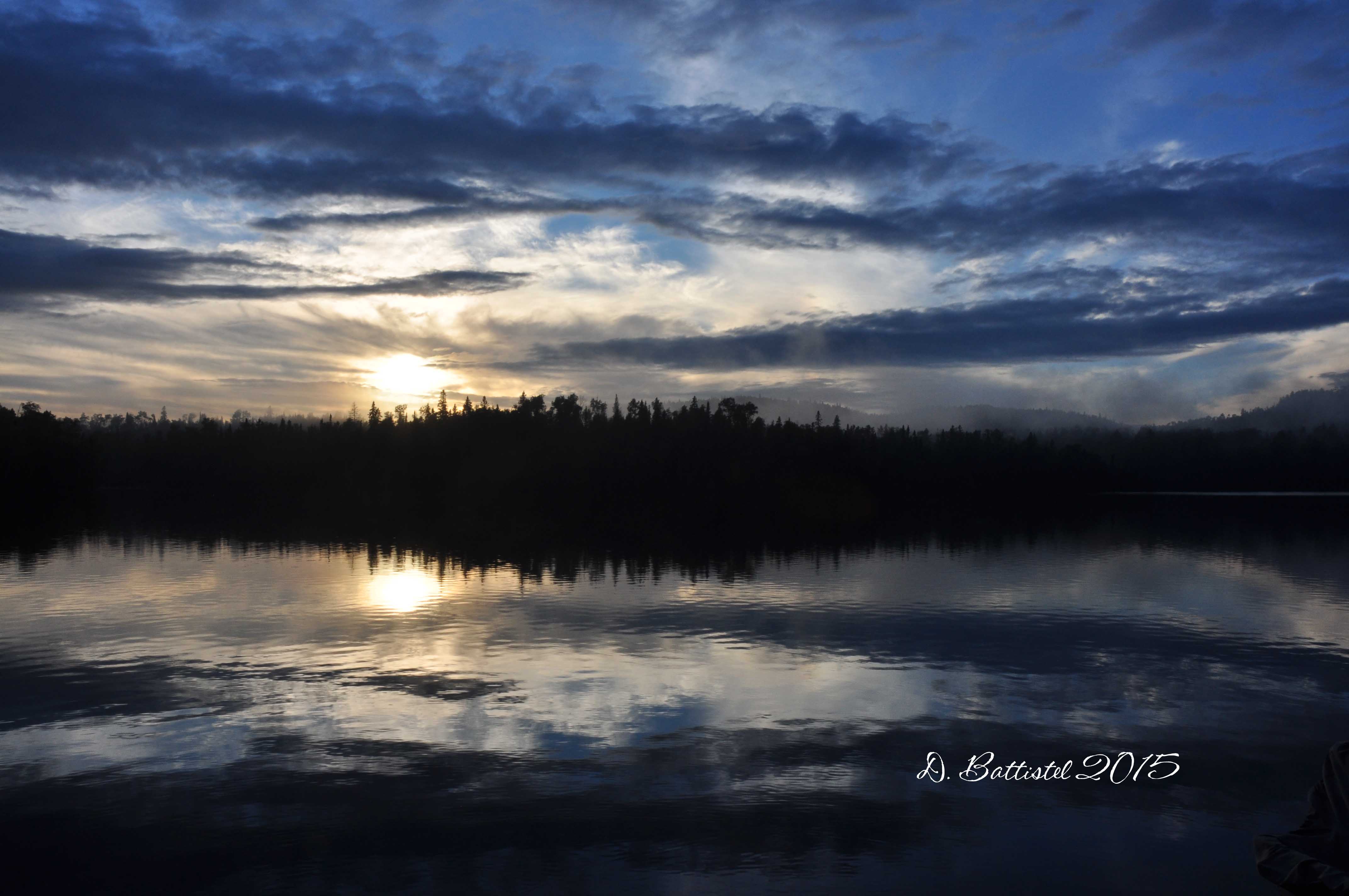
That night I obviously slept well, especially since I had to be up early the next morning. The plan called for me to meet the group at Heston’s Lodge at 8:00 where they would have access to a boat for the day. There was an ominous black cloud in the sky and storm cells on the radar, but mercifully no rain fell.
After a short ride to the south side of the lake, I pulled in at Heston’s and waited for the group to arrive. There had a chance to catch up with owners Greg and Barb Gecas, whom I had met many years before. Greg and I had a good chat about the history of the area, which I hope to continue at some point in the future. After a short delay, we were on our way to Camp 4 by 8:30.
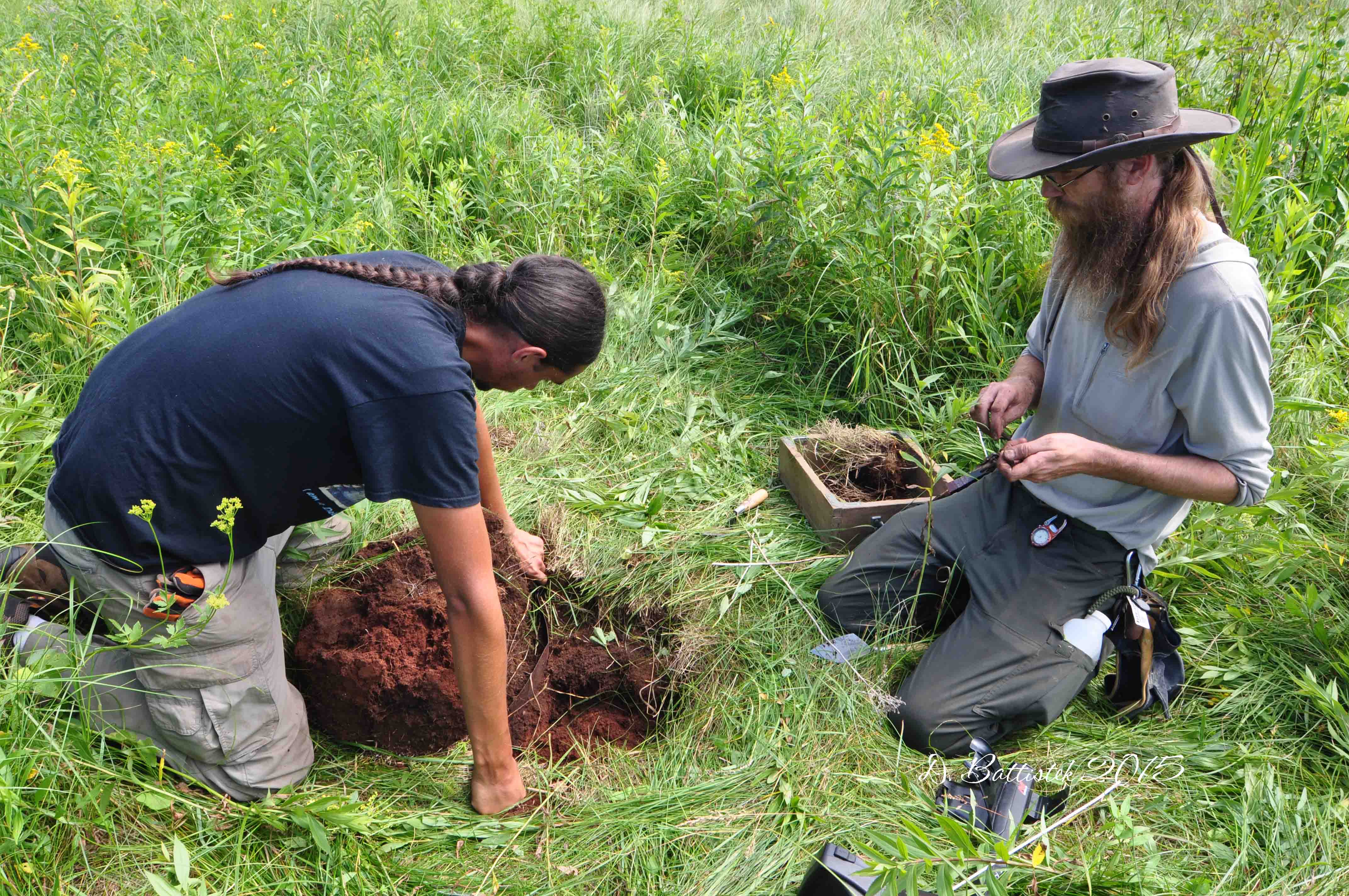
Once ashore, we got our gear together and started with a little tour of the area. The group consisted of myself, Superior National Forest archaeologist Ryan Brown, University of Minnesota-Duluth archaeology professor Sue Mulholland, and two students, John and Eric. I showed the group some of the areas and objects I had discovered, mostly on the surface as I did not want to disturb the soil. Afterwards, Ryan wanted to start working an area of interest he had noted back in 2011.
John and Eric began by sweeping the area with the metal detector and mark each “hit” for later examination. I was able to experience my first taste of an archaeological dig, getting my hands dirty while meticulously and carefully unearthing whatever lay below the soil. We were only able to look at a few spots before lunch, but it told us a lot about life in the logging camp. One area held barrel hoops, remains of a bottle and a metal cup. Another, possibly a fire pit location, contained more hoops, wire, nails and pieces of molten glass.
Camp 4 archaeological dig, July 2015.
After lunch and a rest on the beach (the temperature hovered around 30C), we decided to examine one of the sites that I had discovered during my spring visit. As we began to remove the underbrush it was clear that this spot might be of special significance. There seemed to be a number of metal objects in the area and coupled with bits of coal and what appeared to be slag we were turning up, it became obvious that we had stumbled upon the location of the blacksmith shop. Ryan decided he wanted to do a more formal excavation in the future, so we only investigated a few hits around the periphery of site. We only kept one object, which none of us were able to identify. A posting on social media quickly revealed that this was a brace, used on the outside of steel rails at a switching point. Interesting.
Railway switch brace, July 2015.
Before we departed we had to finish logging all the detector locations, which gave us a chance to look around the area more. Taking a peek inland from the shore at something, I stumbled across a huge jumble of wire coiled near a tree. What was interesting about this seemingly random pile of wire was that it resembled, both in size and composition, the telegraph wire that I had found on Little North and Little Gunflint Lakes. Was this the key piece of evidence I was looking for? Comparing the two at home it seems I could very well have a match.
Camp 4 telegraph wire?, July 2015.
With much reluctance we had to pack up and head back. I am really hopeful that more archeological work can be done on the site in the future, and that I am allowed to participate in the exploration. It is unfortunate that many objects may have been removed from the site in the past, which diminishes we can learn about life in the logging camp.
Please remember, historic sites in Ontario and Minnesota are protected by law and removing objects is both unethical and illegal.
When I arrived back at the lodge, I left the boat there and departed with all my stuff for the short drive to the guard station. I had only booked a couple nights at Cross River, and had decided to spend a night “roughing” it (even though Rose did let me know there was a room available). It had been a long time since I had last camped out in a tent, probably 15 years. It was so long time I had to read the instructions on how to set it up…fortunately they are attached to the outside of the bag so they were not lost!
Seagull Guard Station, July 2015.
After resting a bit, and enjoying a rustically prepared (on my Coleman stove/grill) steak dinner, Ryan and I were invited by a few of the fire rangers to join them in a little civilized fun. Not sure where they dragged it up from, but someone got a hold of a croquet set. I’d never played croquet before, so it was quite the initiation to the “sport.” I may have also made a few off-hand complaints about the conditions of the course! We had a hoot playing a couple games while a “large” crowd gathered to watch. When the sun went down and the mosquitoes swarmed, we retired indoors, where I had a chance to chat a bit with Peter, who was a professor from Iowa State University doing research in the area. Ryan and I ended up staying up to midnight shooting the breeze with Adam, Ryan and Jacob (our original croquet compatriots) and they were very gracious hosts. There were a lot of laughs and they even fed us pizza. What a great way to finish off a few days of hard work!
Since I had forgotten an air mattress to sleep on, I did not have the best night’s sleep, but it was okay given the surroundings. In the morning I had to pack up my tent and bid farewell to the group. I’ll be back at Gunflint in October for more field work, and let’s hope the weather is as equally cooperative. There’s still a lot of things to explore.
So with any luck you’ve learned a thing or two about how (or how not) to get lost in the bush. I could definitely write a book about my adventures but I don’t think there will be a movie deal anytime soon. Who do you think would play me if there was? Maybe an action star, but he needs to be bald…Jason Statham? Works for me. Anyway, I think after 3000 words I’ve said enough. I’ll be back in a few weeks with the latest news. Until then…
No, this isn’t an exposition about my marriage or my attempt to delve into couples advice. Nobody wants to hear me give my two cents about either of those topics. This is rather a commentary about another relationship that affects many people’s lives, an international relationship. You probably have no clue what I’m referring to, so I will explain myself.
The title was inspired by the recent national holidays on both sides of the border, Canada Day and Independence Day. What made me think of this topic? Well, it all stemmed from a post I saw on Facebook on July 4th, very humorously labelling it as “Happy Treason Day” to the “ungrateful colonials.” It made me laugh! It also made me think of the relationship between our two countries; best of friends, but still very different. Many of the people who helped build what would become Canada in the early 1800’s had left the US following the Declaration of Independence and the Revolutionary War, the United Empire Loyalists. My home province of Ontario still bears that legacy in its motto; Ut Incepit Fidelis Sic Permanet -Loyal she began, loyal she remains. One nation forged in rebellion against a country that the other still remains tied to in heritage and tradition. Interesting how things play out!
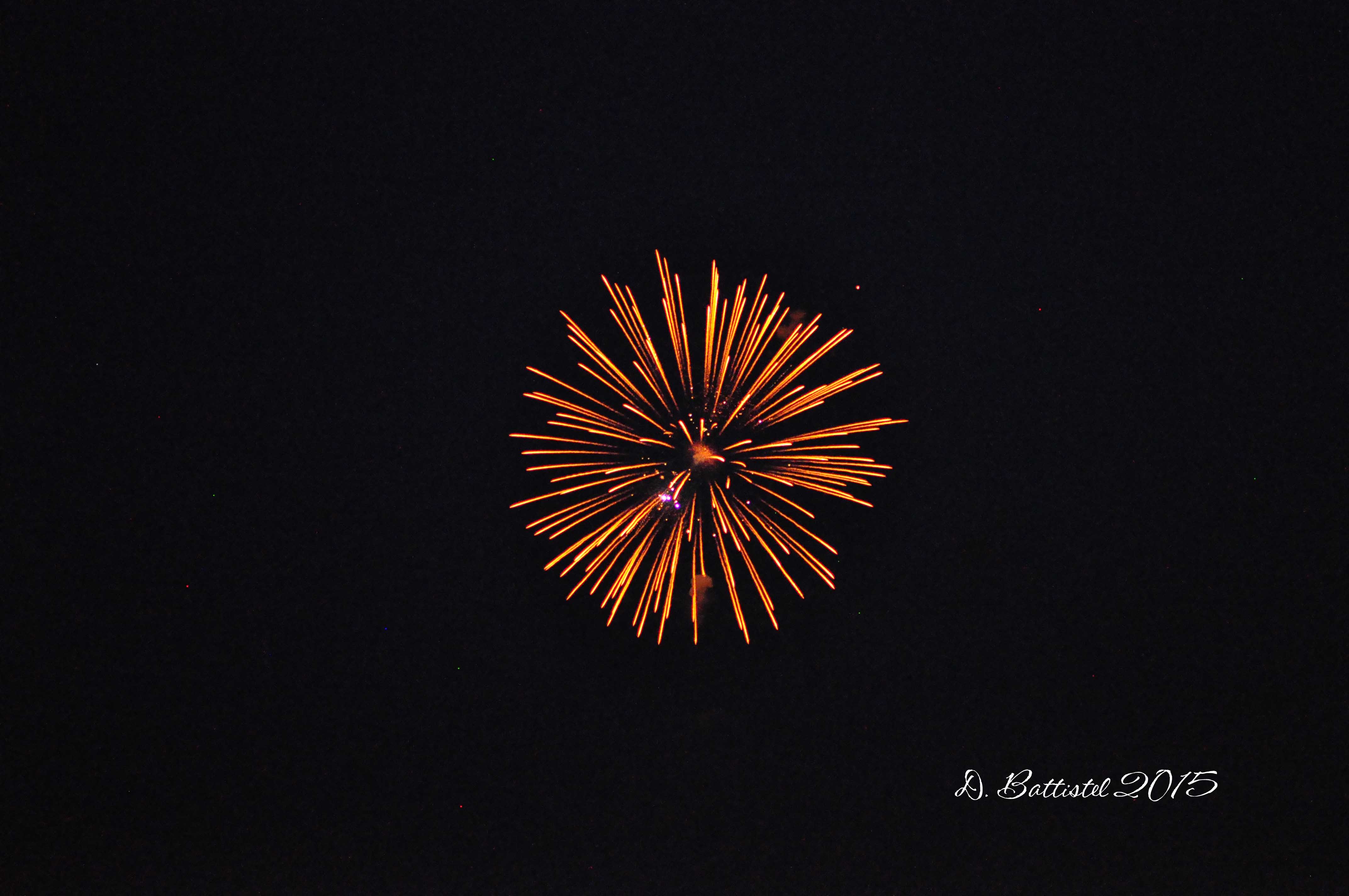
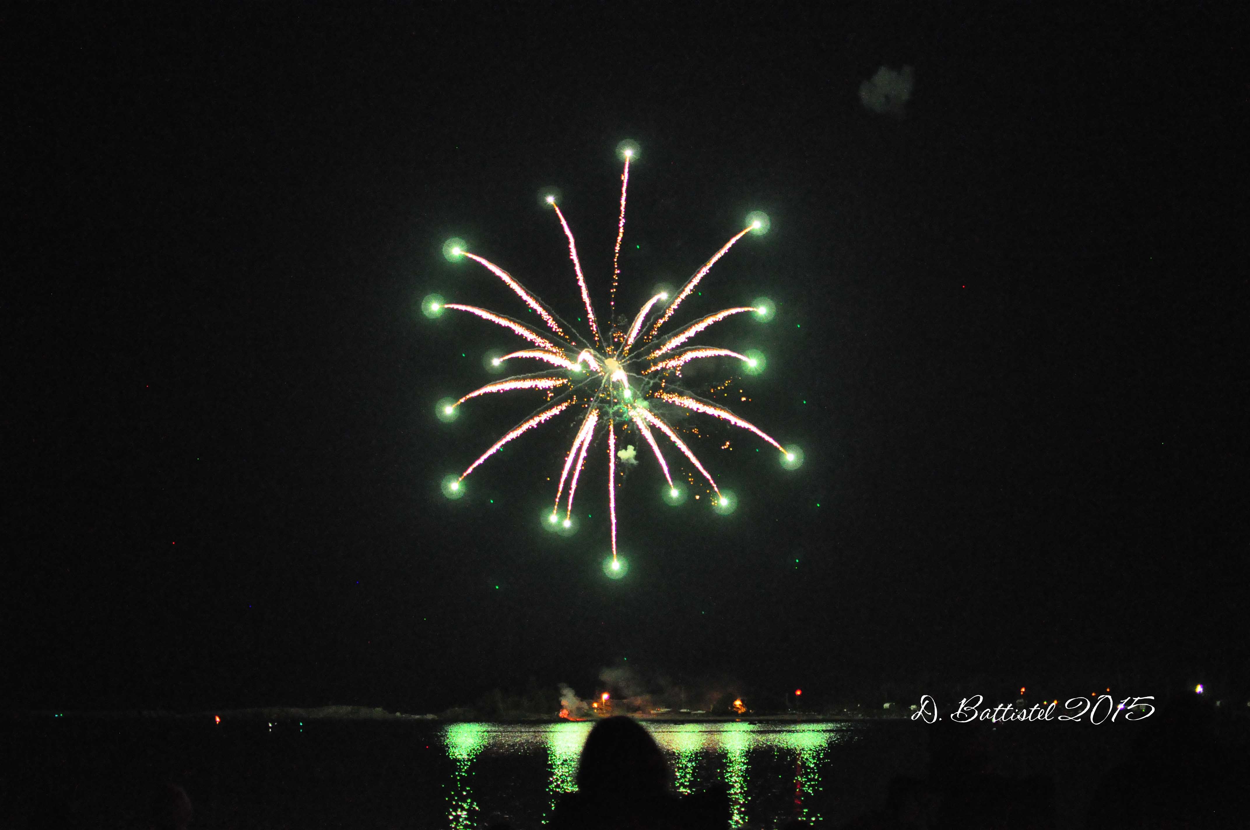
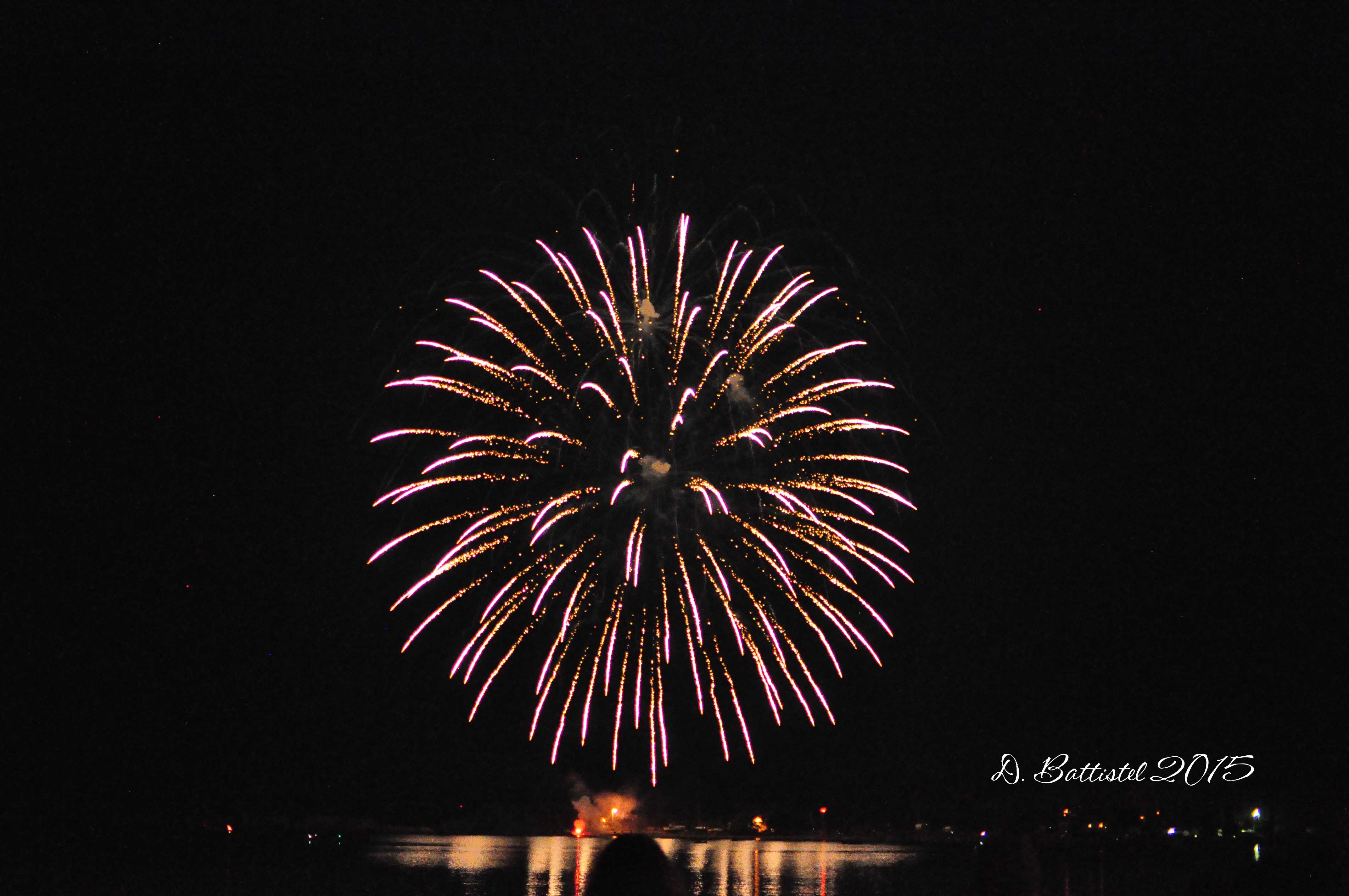
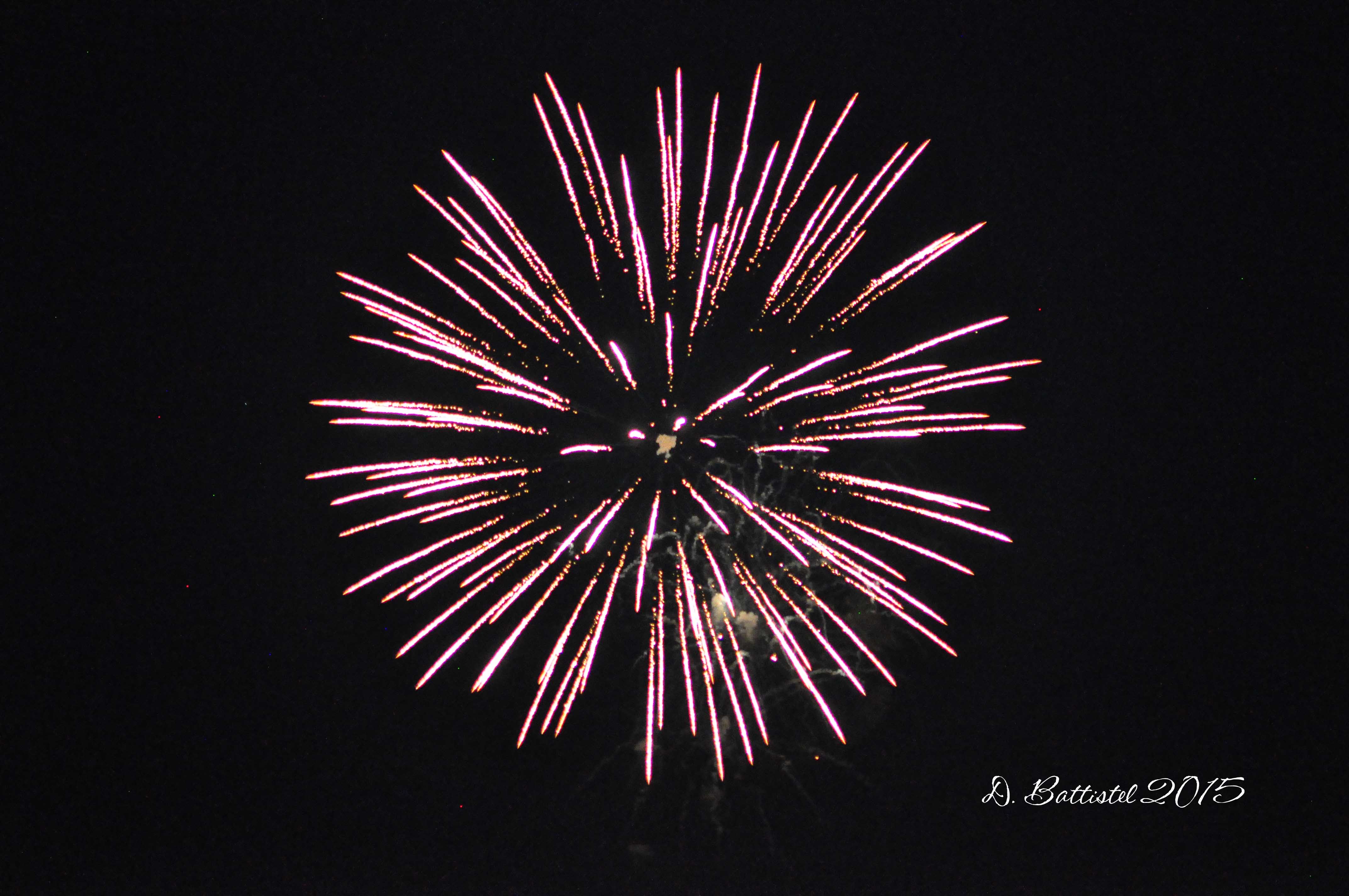
So, here we are into the third week of summer vacation. Wow, that went by fast! It has been relaxing and busy all at the same time. I’ve spent the last few weekends out at camp, which has been a lot of fun for the boys (and for me too). I have had to do some work out there, but it’s all good. Speaking of July 4th, we did travel down to Grand Marais for the celebrations and fireworks south of the border. It was a nice time in a great little town.
Fireworks, July 2015.
Fireworks, July 2015.
Fireworks, July 2015.
Fireworks, July 2015.
When I last wrote I was about to head down to Duluth for the UMD football camp. It was a very hectic 3 days, but fantastic for everyone involved. The players learned a lot and also had a lot of fun. Even though I’ve coached for football for 16 years, there are always new things to see and experience. You can read more about more our time at UMD here.
UMD, June 2015.
In my previous post I also wrote about my excitement for summer and all the hiking I would be able to do. Well, it’s week 3 and I have yet to get out. Why? Well, I’ve been preoccupied with a few other things, but I was mostly waiting for the bush to get a little drier. It seems as though I’ll be waiting a little longer. I was supposed to go out today with the boys and my brother who in town from Toronto, but my evil nemesis, the weather, derailed my plans again. Just as I thought things we starting to dry out nicely, the area southwest of the city got a large dump of rain. The rain gauge in the Whitefish Valley recorded 123mm of rain; crap! I had hoped to get out to the boundary waters to do a little exploring along Little North Lake, but there were washouts and road closures along Highway 588 (the only road out to the area). It’s very unfortunate for all the people in the Hymers and Nolalu area who experienced flooding.
Despite the frustration of the weather, I have been able to do some very constructive work on the railway lately. After my return from Duluth, I was able to head down to Grand Marais for the day to look through the Arpin Papers at the Cook County Museum. If you remember my post from last August, these papers are the personal letters of Pigeon River Lumber Company president Daniel Arpin and are a gold mine of information. I was able to get through another 2 volumes and I’ll have to head back to look through the last two at some point.
Arpin Papers, June 2015.
Arpin Papers, June 2015.
While I was there, I stumbled across a very interesting find. Several years ago, I was shown a photograph of “Merritt’s Camp” by Sue Kerfoot. After learning that this was located at the east end of the lake, I remarked that it resembled the arrangement of buildings that composed the US customs house in that area. The same photograph is in the collection of the Cook County Historical Society, so I asked them for a copy. As it turns out, that the photo was actually taken of an image in a book. Thankfully, the negative also included the title of the book.
George Shiras III was a wildlife photographer who had many of his images published in National Geographic and was a pioneer in the technique of night flash photography. In 1936 he published a two volume collection of his work entitled “Hunting wildlife with camera and flashlight.” Thanks to Amazon and the expenditure of $25 US, I was able to acquire a copy for myself. From the book (and some research), I determined the picture in question was taken sometime between 1919 and 1923. Shiras was in the area trying to photograph moose and stayed at the former customs residence which was at the time owned by the Merritt family of Marquette, Michigan. Sometimes luck is on my side!
Merritt’s Camp, 1920’s.
Next Tuesday I leave for 4 days on Gunflint Lake to take part in an exploration of the former PRLC logging camp with archaeologists from the US Forest Service and the University of Minnesota-Duluth. Hopefully Mother Nature will smile on us while we are there, as this is sure to be an exciting investigation. Some “digging” was done in the area during the 1960’s or 1970’s, but this will be the first detailed and professional examination of the site.
I obviously am very excited and grateful for this opportunity, in part for the potential historical information it may uncover, but also for the simple fact that I’ll be out in the field. I’ve already documented my frustration with the weather, so I think I can be excused for my enthusiasm. Hopefully I can be of assistance to the archaeologists. It would be great if I could come back here in a few weeks and report on some useful discoveries that were made.
In any case, I better get rolling. I promise I won’t wait too long to post my ramblings about the trip. Until then…
Well, it’s pretty much the story of life isn’t it? I think all of us have experienced this at various points during our lives. The ups and downs are all part of the journey and make it all that much more interesting. It can take on many different forms, whether it be about our relationships, careers, school or sports, it doesn’t matter. In this case, I’m referring to something a little different, but when aren’t I? Now that I’ve peaked your interest (or maybe not), I can blather on about a bunch of other stuff first.
So, here we are at the end of June. Despite my best intentions to write more often, it’s unfortunately been over a month since my last post…I guess there are too many other things to preoccupy my time. That means I have a lot to catch up on.
The end of June means that we are days away from the end of the school year. In my case, it’s technically down to one day; in reality I’m on the clock until Saturday, but that’s a story for later. As I’ve stated repeatedly in the past, this year has been a complete blur. The years seem to go by faster and faster. I can’t believe I’m almost done my 17th year of teaching at St. Patrick…geez I’m getting old! With my upcoming semester off, I only have 12.5 years left of teaching. Never mind the year, my life is turning into a blur!
On Thursday I’m forsaking the last couple days of school to travel with the football program to the University of Minnesota-Duluth team camp. We have 25 players heading down with us and as usual it should prove to be a fantastic experience. UMD Head Coach Curt Weise and his staff put on an amazing event for players and coaches alike. The weather is even supposed to cooperate for us while we are there!
With all this talk about the end of school and football trips, we must be heading into summer. Thank Jesus! Yes, I know, poor teacher; life must be rough with all the holidays we get. The fact of the matter is I’m tired and burnt out. It’s not easy teaching teenagers…or any kids for that matter. I know what it’s like being at home all day with my boys and I can’t imagine having them plus another 20 or more for 5 days a week. I’d need to take up drinking! In any case, the time to decompress will be nice and I’ll be able to spend some time with the family (and some me time too).
My railway time lately has been taking a beating with all the other stuff going on, but I hope to change that soon. With the end of the school year, I’ve already planned my first research session of the summer for next week. Last year I spent a whole day at the Cook County Museum in Grand Marais looking through the Arpin Papers, which are the records of Daniel J. Arpin, president of the Pigeon River Lumber Company. I managed to examine four of the books, which at 500 pages per book made for an interesting day. There are still a number of volumes to look at, so I imagine it will take multiple trips to finish it all. I’m sure I’ll be bug-eyed by the end, but I know there will be a lot of great information to come from it.
The beginning of summer of vacation means that I’ll have more time to spend doing field work which will make me immensely happy. At the end of my upcoming trip to Duluth I have a meeting scheduled with all the principals involved in the July exploration of Camp 4. Hopefully we can formulate a good plan to maximize our time in the area. In the meantime, I have a few other hikes on the books along the PAD&W and G&LS to tide me over.
My last trek into the outdoors occurred at the end of May and is reflected in the title of this blog. I was very excited to visit a an unexplored portion of the Gunflint & Lake Superior Railroad, but unfortunately it did not pan out as I expected. One of the biggest mysteries surrounding this little logging railroad is how far it extended into the Minnesota wilderness. It’s route from the PAD&W across the border and 4.5 kilometres to the ridge on the south shore of Gunflint Lake is very well documented. The next kilometre from the ridge to Crab Lake is a little more sketchy but generally known; it is here where the questions begin. According to statistics, the G&LS reached its maximum length in 1907-1908 at nearly 5.5 miles (far short of its planned 30 miles). That means there could have been another 4 kilometres of track beyond where it reached Crab Lake. Where the track was located and how far it extended toward Whisker Lake is unknown.
So my plan was to drive up the Gunflint Trail as far as Loon Lake and then go north to the Crab Lake Trailhead of the Border Route Trail. This access trail extends some 3 km from Loon Lake to Crab Lake and then another 1.5 km to where it meets the Border Route Trail. I would walk and the boys would ride their bikes to where the trail passes between Crab and Whisker Lakes and at that point try and locate any traces of a railroad grade. I hoped my new metal detector would locate any spikes that had been left behind when the rails were removed.
It took us about an hour to reach our destination; along the way I periodically swept the trail with the detector to see if there were any traces of a rail line along the south shore of Crab (I’m pretty convinced that this trail was indeed built in 1936 during a forest fire). At the east end of Crab and on toward Whisker, I swept around with the detector but nothing really turned up. Sometimes you can hype things up too much and end up disappointing yourself. I guess I just assumed I’d get there, find a whole bunch of spikes and see a clearly defined right of way. Most likely if the railroad did extend this far it was a temporary affair and there was not a lot of effort put into the construction of the grade. It’s not that I am giving up, but I’ll have to reload and rethink my strategy. Maybe continuing to follow the grade east from where it meets Crab might help me connect the dots. In any case, it was a nice hike and I got to spend some time with the boys. You win some, you lose some!
Border Route Trail, May 2015.
Border Route Trail, May 2015.
Whisker Lake, May 2015.
Border Route Trail, May 2015.
Border Route Trail, May 2015.
Border Route Trail, May 2015.
Anyway, it’s time to move on. I should be back shortly (I know, I say that all the time) with more news and photos. Until then…
Yes, yes it did. You know the feeling don’t you? Well, I guess everyone does for that matter. What feeling you ask? It’s that “oh my god, I have not done this in forever” feeling. Catch my drift now? I bet you’re still confused though, because I could be referring to a million things right now. I hate to burst your bubble, but it’s not what you’re thinking of…especially if you’re thinking of that! Some of you may have figured it out, but the rest of you will have to keep reading.
So we have reached the middle of May and I’m not sure I’m going to make it another month and a bit. I am burning out very quickly. I have wayyyyyy too many things going on right now…I can barely keep my head above water. Funny thing is if you look back on posts from previous years at this time, I probably wrote the same thing. Not much changes from year to year I guess. What’s keeping me busy you ask? The answer is pretty easy; what isn’t? This is my “other” crazy time, with work, football and family all piling up.
As we near the end of the school year, there is a push to finish my marking, especially big items such as essays. There are a lot of meetings plus the usual timetabling for next year. Football spring training is creeping up fast and then there is the trip to Duluth for the UMD camp to plan for. The kids are busy with swimming and soccer and there are a thousand things to do in the yard (we all know how much I love yard work!).
I don’t think I could write a blog post without commenting about the weather can I? So, what to say…well, how about crap? The sun and warmth of April and the first part of May has been replaced with cold and rain. Makes me happy doesn’t it? Just when I thought things were looking up for a dry and hot spring and summer, Mother Nature has decided to dump all over that idea. I guess the up side is that there is still a lot of time for things to turn around…I hope!
With all the craziness of late, I have had a little time to spend on railway stuff. There has been a lot going on with the Silver Mountain and Area Historical Society as I reported in my last post. On the 4th the board was present at the city council chambers as we made our deputation to ask to have the CN Caboose donated to the society. I was very nervous as I had never done anything like this before and it was made worse by having to wait a long time for our turn to speak. I did my best to make our case to council; it is now up to them to decide if they want to keep it or donate it to us.
Alright, so let’s get to this feeling stuff shall we? Well, if you’ve read some of my recent posts you’ll know that I’ve been really looking forward to getting out and doing some hiking. Fortunately I was able to do just that last weekend. The plan was to drive down to the Minnesota side of Gunflint Lake and then take my boat across the lake to do some exploring on the Gunflint & Lake Superior Railroad.
Things went fairly well, though I did have to deal with a few wrenches in my plan. The day was supposed to be partly sunny, but the sun decided not show up until we were ready to leave. Then there was the boat. So last fall when I was at Gunflint, the motor seemed to be acting up a little bit. At the end of April I had it looked at and apparently it needed a new carburetor kit and had a loose ground in the throttle assembly. A week of waiting and $400 later I assumed everything was peachy. Wrong!
Gunflint Lake is approximately 7 miles long and normally it would take about 20 minutes or so for my boat to travel that distance. Not on this day. About two minutes into our journey, the motor started to sputter and then would not accelerate beyond 1/3 speed, even with the throttle wide open…obviously something was up. In any case, I was not about to let the day be ruined, so we puttered along at a snail’s pace. Twenty minutes became almost an hour to get across the lake!
Because of the delay, I had to modify our plans for the day. The first stop on agenda was the former Pigeon River Lumber Company logging camp at the east end of the lake. I mentioned back in February that I would be participating in some archaeological explorations at the site this summer, so I wanted to do some preliminary work to prepare. With the GPS in one hand, metal detector in the other and the boys in tow, I spent an hour or so documenting and photographing the area. For obvious reasons I don’t want to say too much about what I found, but I’m sure I’ll have more to say once the professionals have a chance to do their thing.
From Camp 4 we crawled our way north, first to the site of the second bridge crossing at the next bay and then to the international boundary. The water level is down a bit from last year, so I wanted to see how much more was visible of the bridge pilings at that second crossing. I think if it drops a bit more, there will be a lot to see, but it may be a challenge getting into that shallow bay!
At the international crossing, I had more exploring to do at the site of the former US customs house. It’s another place that does warrant some investigation and maybe that will get some attention once the logging camp is done. My big task was to try and see if an image in the files of the Cook County Historical Society was in fact the customs house. After taking some pictures and comparing them to the one in question, I’m pretty positive I’ve made a match. At some point I’ll have to get some exact measurements that will help with the identification.
International Crossing, May 2015.
G&LS Grade, May 2015.
Custom house flagpole, May 2015.
Custom house location, May 2015.
G&LS Grade, May 2015.
Fishplate connector, May 2015.
G&LS Rock Cut, May 2015.
G&LS Grade, May 2015.
With an hour ride back to Cross River lodge, that was my last stop for the day. Hopefully I’ll have a chance to get back to Gunflint in the next few weeks…if the weather cooperates. There are so many things to look at and such little time. Maybe next year when I’m off I’ll have more of an opportunity to get out into the field. Of course that will also depend on what Mother Natures has in mind.
Anyway, I think it’s time to get rolling. It is in fact Victoria Day, so I should get out and enjoy this wonderful holiday; oh wait. In any case, I’ll be back soon enough…until then.
Overrated? Well, I guess that’s a little too far. As usual I’m being a facetious, but I think it accurately reflects my life over the last few weeks. Breathing has certainly been a challenge and it really makes you realize how we can take something so simple and vital for granted. You’re confused right?
As some of you may have guessed, I’ve been sick…very sick. Actually, it’s probably the worst I’ve been in a long time. My oldest son Ethan became sick over the March break with a fever and a lot of coughing. Turns out he had a bronchial infection. From him it went to my younger son Noah, and of course to me. I had a number of days of fever, chills and headaches and then the fun started. I too must have had the bronchial infection because breathing became a chore. It felt like I had phlegm in my lungs, which made me cough, but nothing would come up. It was like I had smoked for 50 years! I was always out of breath and felt so run down because of it. It’s been over three weeks now and I finally feel like I’m getting back to normal. I’m still a bit sniffly, but it’s a million times better than what I was.
So despite my ill health of late, I am very happy. The snow is all gone…thank the Lord! We had some rain last week and a little dip in the temperatures that resulted in a dusting of snow, but I don’t care. The last two springs were brutal and it took forever for the snow to go away. This year is much closer to normal and hopefully that will translate into warmer days and a much better summer. That should help dry out the bush as well, so I might have more opportunities to go hiking!
April 27, 2014.
April 29, 2015.
It’s hard to believe we are almost through April and by the end of the week we will be into May. Holy cow time is flying by! Before we know it, the school year will be over. May and June are usually a very busy time between work and family, so it will go by even faster. Things are starting to pick up with football and will get even more hectic in the coming months. Noah has had skills and drills the whole month of April, which I’ve been involved with. In June our school program will start our spring training camps, which will then spill into our trip to Duluth for the UMD team camp from the 25th to the 27th. Good thing I get paid lots to do it!
With everything that has been going on, and being sick, I have not had a lot of time to devote to railway matters. Much of my “railway” time has gone into the historical society. On March 29th we had our annual general meeting and I was acclaimed as the new president until 2017; new title, same responsibilities. We have a number of projects on the go, the chief of which is an effort to re-locate the “CN Caboose” from its current location at Prince Arthur’s Landing to Silver Mountain. It was originally donated to the City of Thunder Bay in 1990, but the group that was supposed to maintain it has since dissolved and it is in a state of disrepair. I have to go before city council and make a deputation to have it donated to the society…then we have to move it should they approve our request!
Although I have not had a lot of time to spend on the railway of late, I am looking forward to the start of hiking season. Last week I took my boat to have some repairs done and hopefully it will be ready for a trip to Gunflint by the second week of May. I’d like to take a look at a few things and possibly do a little site survey at the logging camp in preparation for the archaeological work happening in July. There is ice still on Gunflint Lake, but from what I understand, it should be gone by next week. Now I just need the weather to cooperate and I’ll be good to go. I’ve got a lot of explorations planned for this year and hopefully I’ll be able to get to as many places as possible.
Anyway, time to roll. I’ll be back before you know it with the latest news. Until then…
Is that straight forward enough? I figured I’d get to the point and not tiptoe around the issue. It’s like stupid tired at this point. Too blunt maybe? Well, frankly I don’t really care. I’m sitting here right now at 9pm and I feel like going to bed. My eyes are heavy and my contacts feel like glue. It’s a struggle to concentrate and organize my thoughts. So what’s the story morning glory? Read on…
If you’re thinking it’s been a while since you’ve heard from me, you’d be correct. It’s been a very, very busy fall; hence the reason why I’m so tired. We are now into November and I can’t believe how quickly the last two months have flown by. What a blur!
If you’ve read this blog before you know that this time of year is the craziest for me with work and football. But some respite is on the horizon, and none too soon. Minor football is done for the year, so I’m no longer doing double and triple duty coaching. No championships for either of the boys, but I know they had a lot of fun on their respective teams. Next year they are both moving up, with Ethan going on the PeeWee and Noah stepping up to Atom.
Tomorrow is the last day of high school football as well; for the third time in four years we are playing in the championship game. We finished the regular season at 4-1, and defeated Hammarskjold in Tuesday’s semi-final game to make it this far. We are playing our sister school St. Ignatius for the second year in a row, who accounted for our only loss of the season. It’s supposed to be -5C with 30-50kph winds…wish us luck!
Besides the regular grind of work, the other thing keeping me busy is planning another trip to Europe. In 2017 Canada will be marking the 100th anniversary of the Battle of Vimy Ridge. Our board has graciously allowed us to go on the excursion and join the thousands of other Canadians who will be there. There has been a lot of interest in the trip and the toughest part is going to be selecting the lucky 21 who will make the trip. Departure in 881 days!
As you can imagine with the insanity that is my life I have not had a lot of time to devote to railway stuff. I have spent a little bit of time here and there doing some research or transcribing notes, but nothing major. Once things slow down a bit I’ll be back at it. However I did have the opportunity a few weeks ago to take a break from the grind and spend some time doing fieldwork. I also got to spend some quality time with the boys on Canadian Thanksgiving weekend…two of the things I’m most thankful for. This trip would be my second visit this year with my good friend John at the Cross River Lodge on Gunflint Lake.
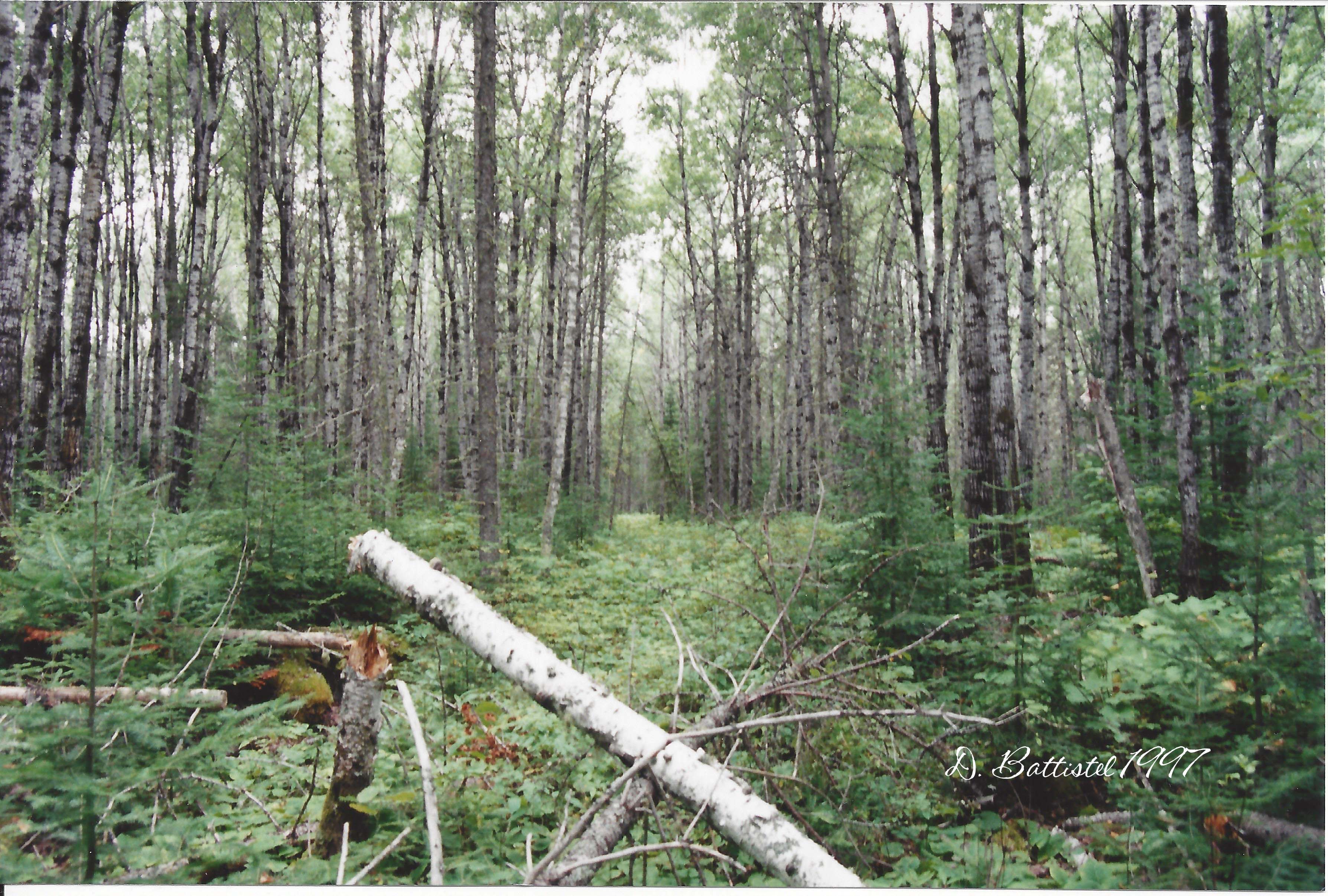
The purpose of this expedition to the bush was to take a look at portions of the Gunflint and Lake Superior Railroad, much as I had done in the summer. Before that, I had last been on the G&LS back in 1997, which was a very long time ago. Much has changed since then, especially after the 1999 blowdown and 2007 Ham Lake fire. There were also sections of this railroad that I had never been on, and that did not appear on any maps, so I would be heading into some real unchartered territory.
It was supposed to be a beautiful weekend, so I decided to take the day off on Friday so we would have almost three full days of hiking. After a brief stop in Grand Marais for some food, we arrived at the lodge by 9am local time. A short time later our gear was stored and we were on our way across the lake. If there was only one complaint from the weekend was how windy it was on the lake. It is a 10 km ride to the east side of the lake and the wind it a rough and chilly ride. With extra layers, gloves and a toque, I felt like I was going to Siberia!
The objective of the first day’s hike was to explore about a kilometre’s worth line along the south shore of the lake. We beached the boat at the same backcountry campsite we used on our previous visit in August and proceeded up and over the ridge between the lake and the grade. The trek was much easier this time with the cooler temperatures and the lack of underbrush. A few minutes and 90 metres later we were standing on the grade. It was much warmer and less windy away from the lake, so we had to take a moment to shed a layer to keep from overheating.
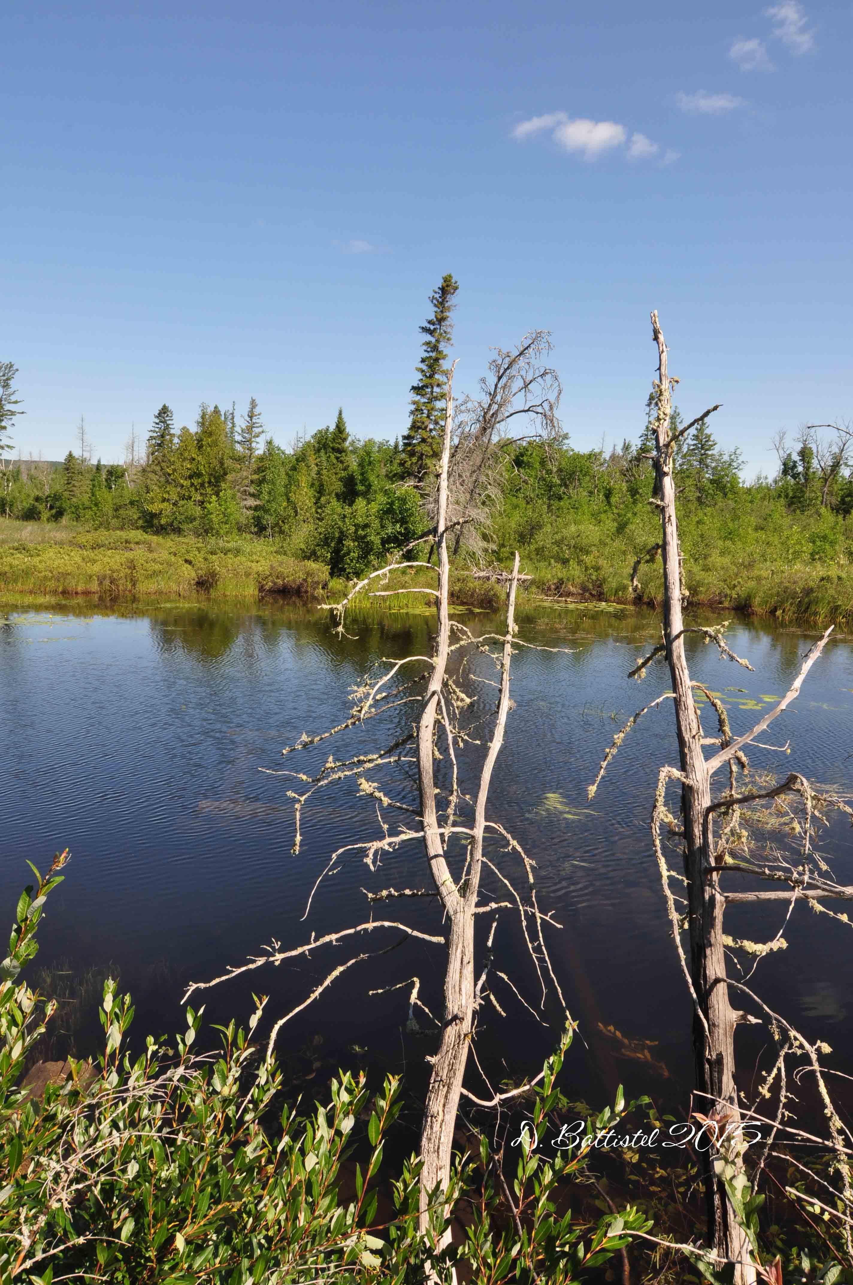
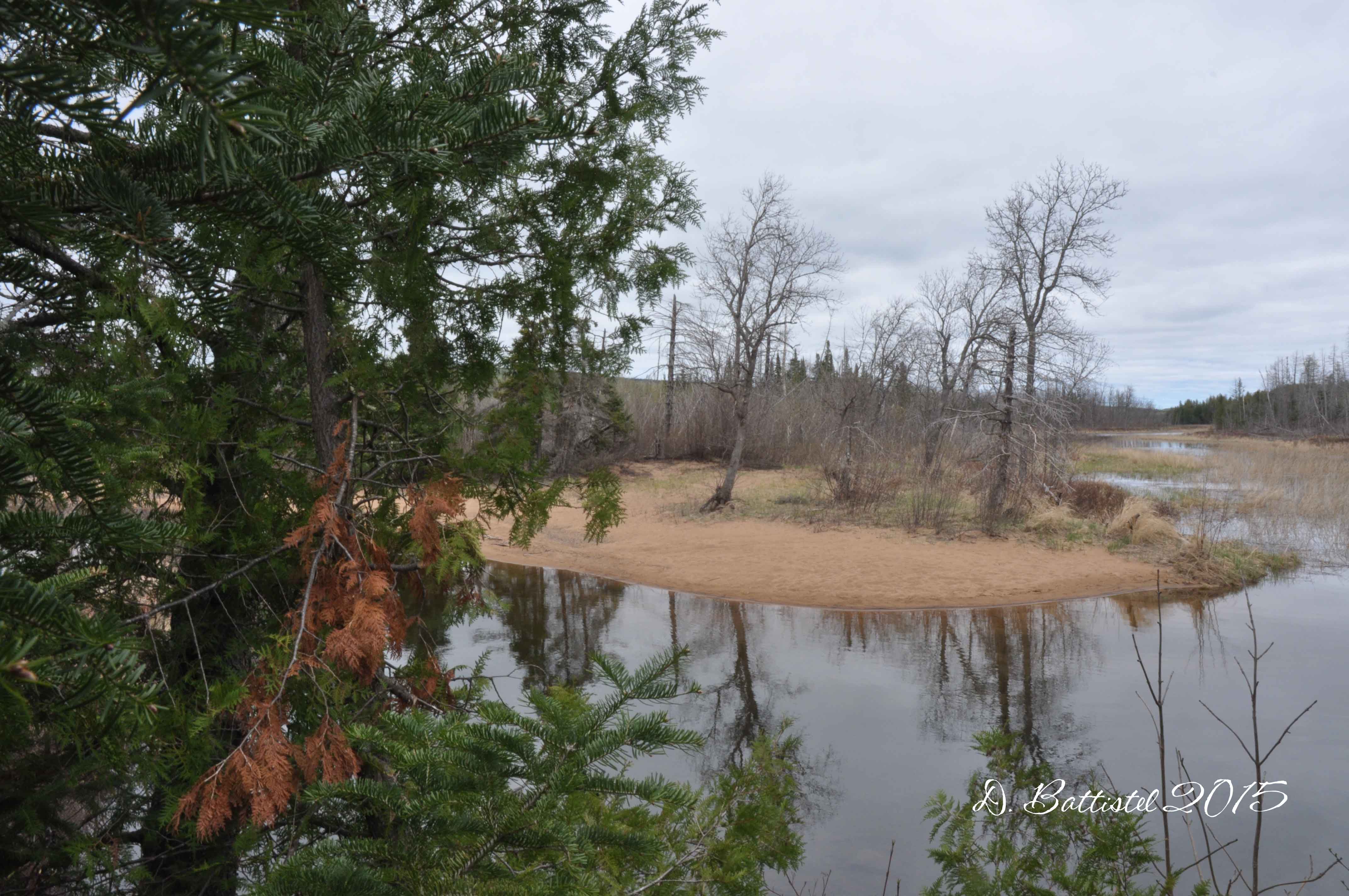
We would first head east along the former right of way, a distance of about 400 metres, which would take us to a point just south of the former logging camp. Here we would have to turn back, as approximately 50 metres of grade has been submerged by a rather large beaver pond. The journey west would cover almost 900 metres, a walk highlighted by the beautiful fall folage.
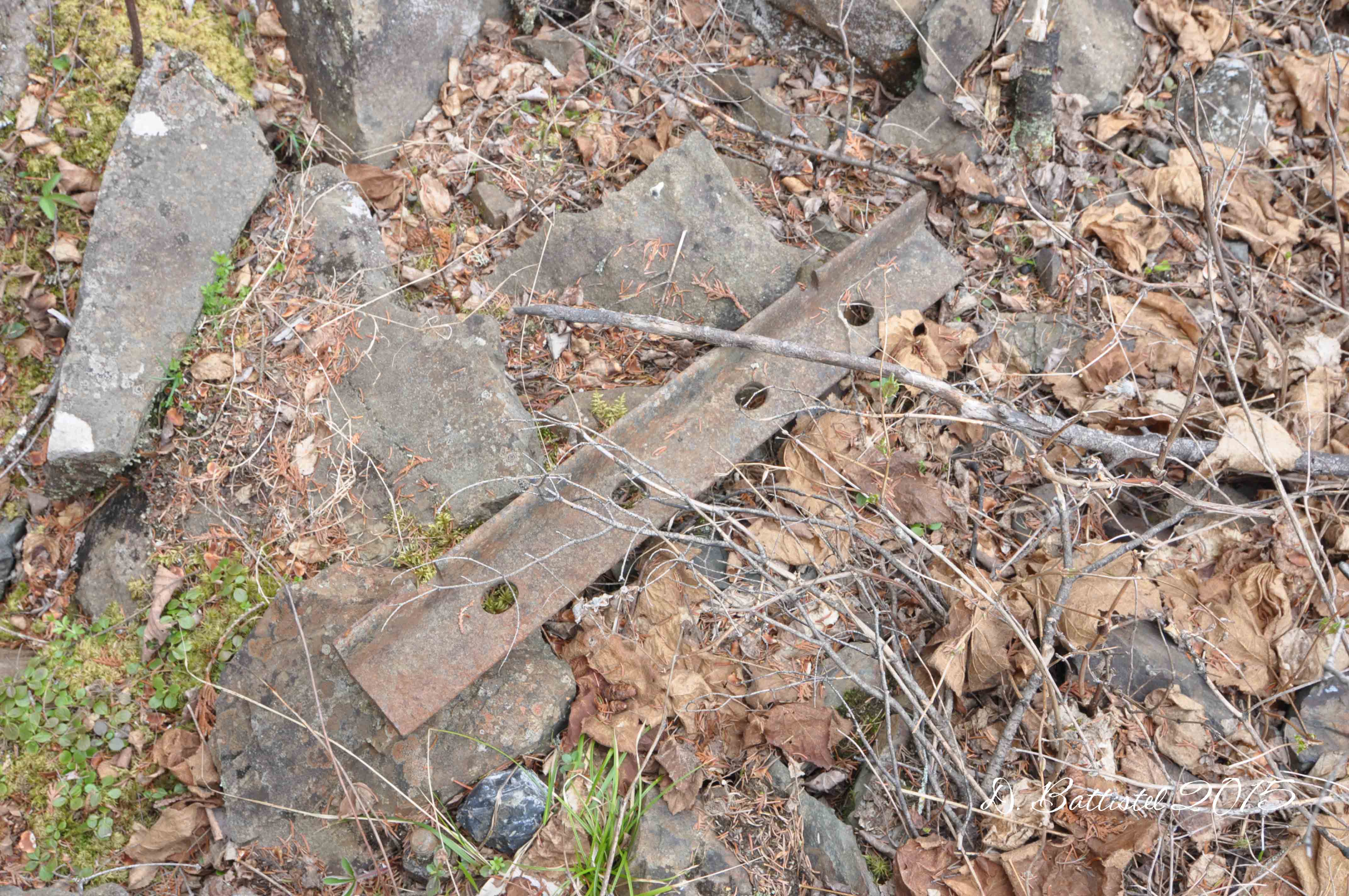
A few metres west of our original starting point resides one of the great locations along the whole G&LS. On my 1997 trip I discovered a spot where a section of rails had been left in place; in August the boys and I re-acquired these rails and marked them on the GPS. These 40lb. rails had been purchased from the Illinois Steel Company in the spring of 1905 and are marked “Illinois Steel Co. Union 92 IX.” The absence of foliage made the couple sections of rail in this area a bit more visible than they were in the past.
A short walk further west brought to another section of rails that we had discovered back in August. These rails were unique as they were clearly part of a junction that formed a spur or siding. The ties are gone, but very visible are the metal spacers/separators for the rails. Working back east, I was able to determine that this was the western end of a siding. It is not indicated on the International Boundary Commission map which was surveyed in 1911, but it is very clear from the grading work on the ground. With a very steep ridge just south of this location, it makes perfect sense to have a siding in this spot to shunt loaded log cars in preparation for the trip over to North Lake.
Rails, Gunflint Lake, October 2014.
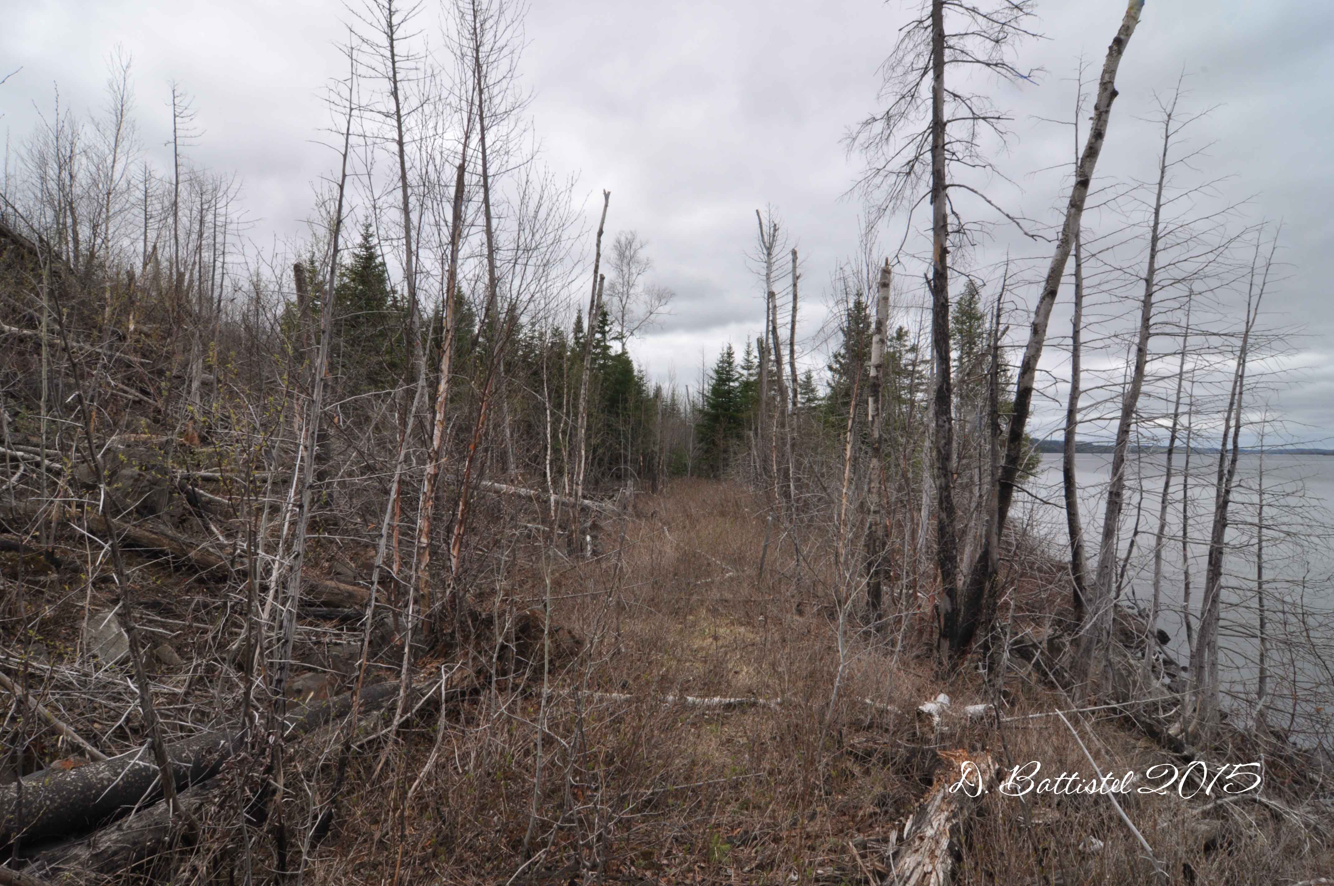
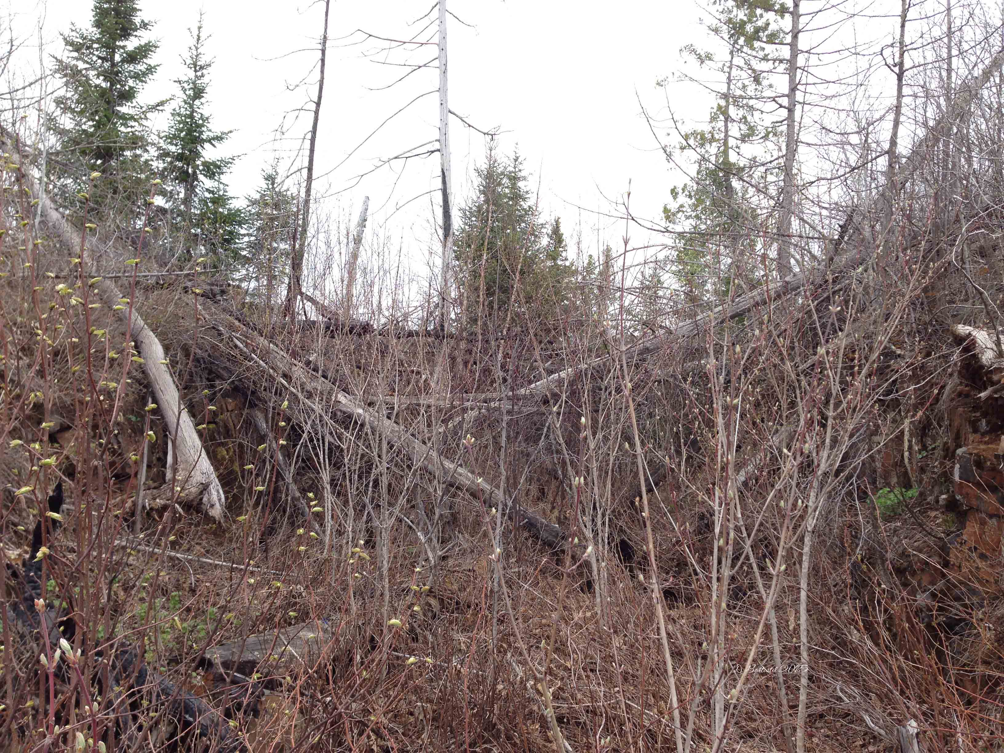
Beyond the junction the incline of the grade grows increasingly noticeable as it passes through a cutting on a small hill before it turns south alongside the Crab River. To climb the large ridges south of Gunflint Lake, the railroad used the small hill to gain elevation. Instead of constructing an elaborate trestle to bridge the valley between the hill and the ridge, the engineers filled the chasm with corduroyed logs until they had the necessary angle and topped it all with gravel. This expedient structure was built around 1905 and lasted for 102 years. I was in awe when I saw it back in 1997, these stacked logs towering over my head. I would still be there today had it not been for the 2007 Ham Lake fire. The corduroyed logs, possibly soaked in creosote, were burned and stubbornly smoldered throughout the winter of 2007-2008. Afraid of potential flare-ups, the US Forest Service had to dynamite the trestle in March 2008.
Log Trestle, Gunflint Lake, October 2014.
The boys and I climbed 75 metres over the remains of the trestle and headed southward through the rock cut that had been blasted into the top of the ridge. After another 125 metres we arrived where the Border Route Trail intersects the railroad grade. We decided to follow the trail westward over the Crab River and then took the short branch to the north that bring you to Bridal Falls.
After heading back to the boat, it was across the lake to the lodge; unfortunately the wind had picked up and was now howling from the northwest. We absolutely froze on the ride, me more so as my face was being pelted by spray as I attempted to cut the whitecaps. It took me quite a while to warm up afterwards!
The next day we were up bright and early, and after the boys had (second) breakfast at the lodge, we started toward the east side of the lake again. It was already windy by the time we left, so I knew it was not going to be a pleasant ride back. Our task for the day was to follow the grade along the Crab River southward to Crab Lake. It would not be an easy walk, as there are very few traces of the railroad beyond Bridal Falls.
We left the boat on the shore of a small bay and walked the 500 metres of trail to the falls. From there we picked up the branch of the Border Route Trail that took us back above the falls. Our journey would be further complicated by a discovery we had made the day before; since my visit in July, beavers had dammed the river above the falls, flooding the grade for an unknown distance. I had to leave the boys for a few minutes while I probed for a way around the flooding. It took us an extra 100 metres of walking to detour around the pond, but eventually we got back on track.
Rock cut, Gunflint Lake, October 2014.
Back on the grade, we followed the line south for another 140 metres before we reached another swampy area. The boys waited at the edge while I tried vainly to see if I could find any traces of the grade. After a little bit of wandering around I decided to see if the I could find something closer to river; big mistake! My misplaced step put me up to my knees in freezing cold water, which instantly flooded my rubber boots. The boys thought it was rather amusing as I sat on a rock and poured muddy water from my boots and attempted to wring out my sodden wool socks.
With the route of the grade in doubt, we found a trail that would take us southeast to a small lake formed by a bend in the river and cut out about 300 metres of walking (it was already getting tough on the boys). When we arrived at the lake I left the boys to eat a snack while I hiked westward along the shore of the lake to see if there were any traces of the grade. I walked about 120 metres and in two places found what appeared to be corduroyed logs sitting just below the surface of the water. Collecting the boys, we headed east and then south along the shore for another 200 metres.
Where the lake narrowed back into a river we saw evidence of what appeared to be blasting work through some rock for about 90 metres. A short distance later we passed through a small cutting and then reached Crab Lake. The boys sat and ate their lunches while I pushed further ahead a little bit along the shore. I was pretty sure I was on top of the grade, but there was no way I could drag the boys another 800 metres to the other end of the lake…it was time to head back.
Cutting, Crab Lake, October 2014.
We stopped briefly at Bridal Falls so I could take some photos of this very breathtaking cataract. I first saw the falls (also known as Bridal Veil Falls) back in 1997 and I have been back several times over the years. The boys were anxious to get back, so we didn’t linger very long, but I was able to get a few good shots.
Bridal Falls, Gunflint Lake, October 2014.
The wind was howling again on the lake, this time much stronger from the west. Gunflint Lake is surrounded by high ridges on both sides of the lake and is oriented in an east-west direction. With a maximum depth over 200 feet and no features to impede the wind, it can become downright nasty when the wind is from the west. Poor Noah had the bumpiest ride of his life as we battled the whitecaps across the lake; I was very glad to finally make it back to the lodge!
I had promised the boys we would go “out” for supper one evening and Saturday was that day. After a wonderful shower in our room, we headed over to the Gunflint Lodge. We stopped for a quick hike along part of the Border Route Trail, which affords a spectacular view of the lake, especially the Gunflint Narrows. The meal at the lodge was fantastic; based on our previous experiences on portion size the boys split a triple-decker club between them. Dad opted for the Royal Trifecta, which on paper seems like a coronary waiting to happen. But since I walked 4.5 km cross-country and didn’t eat much, I demolished the hogie bun layered with ham, pulled pork and bacon with a great amount of gusto. It was delicious!
Gunflint Lake, October 2014.
Our last day of hiking was “supposed” to be easier than the previous one, but as usual it didn’t turn out that way. The plan was to head north along the grade from the site of Camp 4 to where it crossed a creek, a distance of 1.5 km. Unfortunately the route proved much more difficult to negotiate than I anticipated, with a lot of deadfall from the blowdown and fire impeding our progress.
As with the previous days, it was quite cool on the lake, but we were forced shed layers on the walk, even though we were a short distance from the shore. We were forced to zigzag our way along the grade, climbing over or under fallen trees and chopping at branches in our path. We only made it about 400 metres before we turned back, since I knew the boys would not be able to handle the breaking trail work much longer.
Rock cut, Gunflint Lake, October 2014.
On our way back, we came across a solitary rail just a few metres north of where Camp 4 was located. I tried to find some markings on it, but it was too badly worn. These rails, from the main line of the PAD&W to the camp, were originally laid by Canadian Northern crews in the fall of 1902. Afterwards the boys went back to the boat for lunch while I spent some time poking around the site of Camp 4 and shooting some video. I’ll have to get back at some point and see if I can turn up anything new or interesting.
After the boys had “recharged” with some food, we were going to finish the day by hiking from Camp 4 approximately 350 metres to where the grade is flooded by the beaver pond. Most of it was fairly easy to follow, though it does get a bit sketchy were the grade meets the dam and beyond. When we reached the eastern side of the flooded cutting we had hiked to on Friday it was time to turn back.
Cutting, Gunflint Lake, October 2014.
The next morning we headed home bright and early (and of course the lake was nice and calm). It was Thanksgiving that day so we had to give mom a hand getting dinner and the house ready for our guests. Hopefully the boys remember these expeditions when they get older…I told them they could tell their kids about their grandfather and his crazy hikes. I know I will cherish these times forever.
Anyway, I better get rolling; I have a an early morning and a very busy day tomorrow. I promise not to wait another two months for my next post. Until then…