Video of the former Canadian Northern Railway/CN-Kinghorn (Dorion) Subdivision (MP 83-87.3) south of Macdiarmid/Biinjitiwaabik Zaaging Anishinaabek, ON. Features the 1058-foot tunnel known as the Macdiarmid or Jumbo’s Cove Tunnel, which is one of the longest railway tunnels in eastern Canada. During its construction, three workers tragically lost their lives between January 16 and 31, 1912.
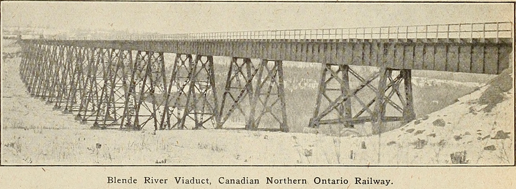
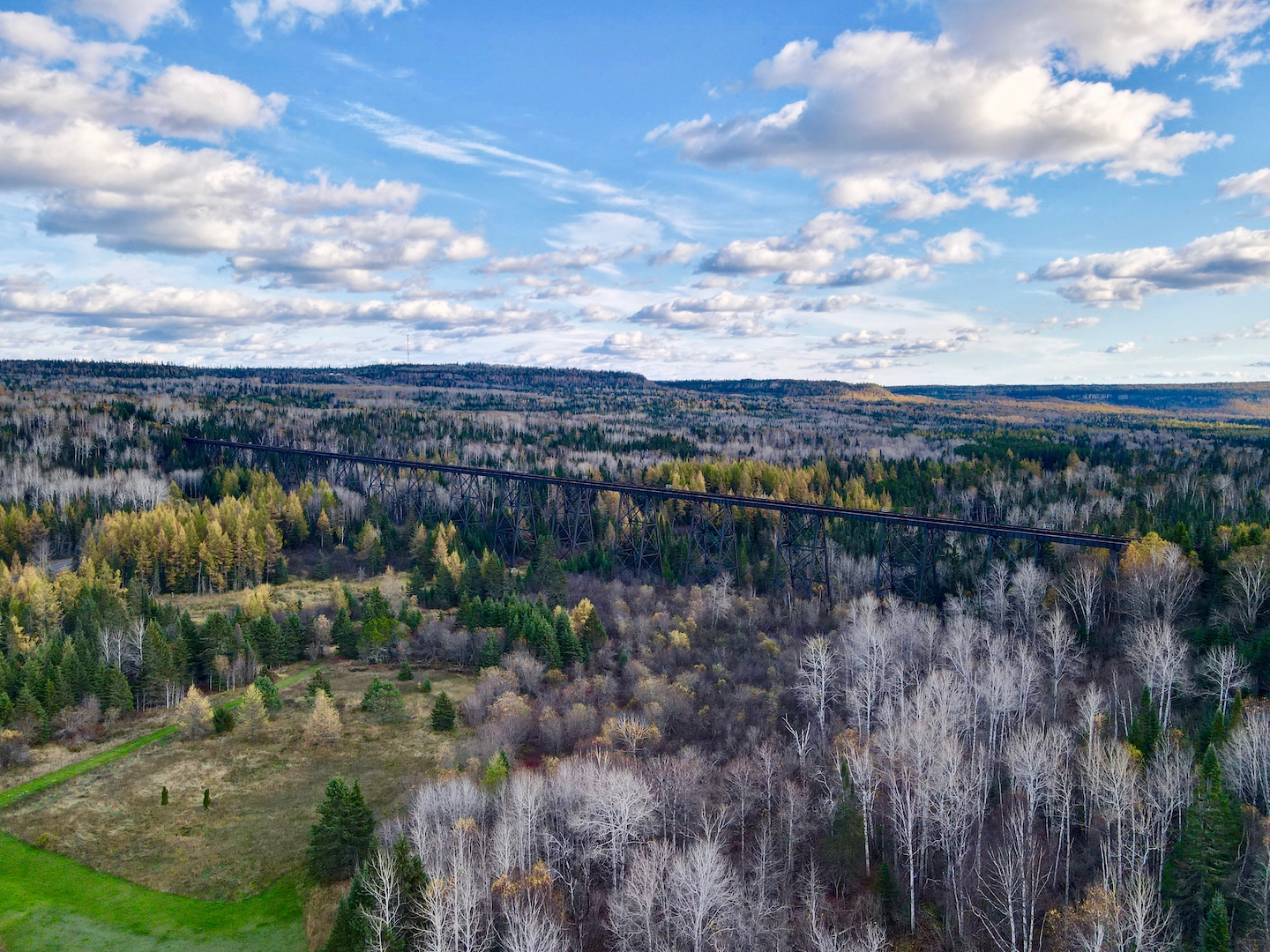
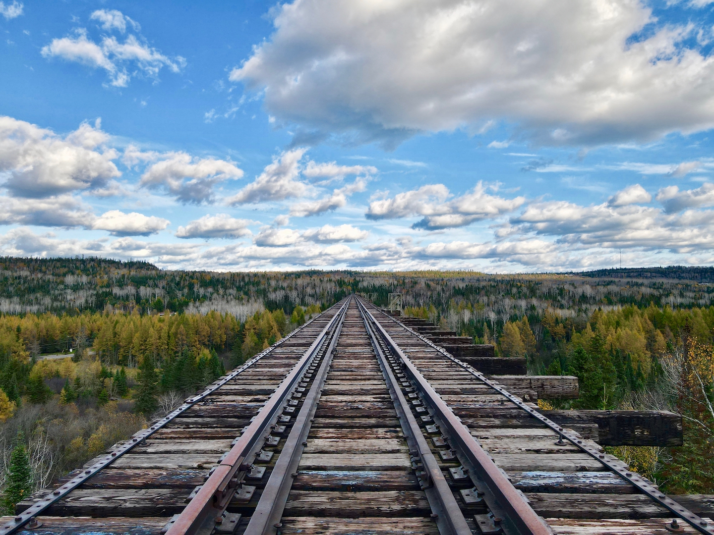
One hundred ten years ago this week, the first train rolled over the Blende River Viaduct, which is more commonly known as the Pass Lake Trestle. Constructed between May and December 1912 by the Canadian Northern Railway, the viaduct stretches 2258 feet across the Blende River Valley and 130 feet above it.
Opened for traffic in 1915, it remained in use until 2005; the rails around the viaduct were removed in 2008. The iconic structure remains the longest railway trestle in central Canada.
Then and now photos featuring the Blende River Viaduct, more commonly known as the Pass Lake Trestle. Located northwest of the community of Pass Lake, ON, the first train rolled over its spans 110 years ago this week. In May 2005, the last regular train crossed the viaduct and the rails around it were pulled up in late 2008.
Constructed between May and December 1912 by the Canadian Northern Railway, the viaduct is 2258 feet long and 130 feet high. To bridge the wide Blende River Valley, workers poured 3600 cubic yards concrete and placed 5 million pounds of steel at a cost of $350,000. It remains the longest railway trestle in central Canada.
The viaduct as completed, circa 1913.Viaduct, August 2021.Viaduct, October 2021.Viaduct, October 2021.Viaduct, October 2021.Viaduct, March 2022.
Video of the former Canadian Northern Railway/CN-Kinghorn (Dorion) Subdivision (MP 64.6-69.1) east of Beardmore, ON. Features the grade as it skirts the Blackwater River with telegraph poles and the remains of the sidings at the Northern Empire Gold Mine.
Video of the former Canadian Northern Railway/CN-Kinghorn (Dorion) Subdivision (MP 64.6-69.1) east of Beardmore, ON. Features the grade as it skirts the Blackwater River with rock cuts, telegraph poles and culverts.
Video of the former Canadian Northern Railway/CN-Kinghorn (Dorion) Subdivision (MP 64.6-69.1) east of Beardmore, ON. Features the grade as it skirts the Blackwater River with rock cuts, telegraph poles, a rare stone culvert and the remains of Spooner Mine siding.
Video of the former Canadian Northern Railway/CN-Kinghorn (Dorion) Subdivision (MP 64.6-69.1) east of Beardmore, ON. Features the grade as it skirts the Blackwater River with rock cuts, culverts and milepost markers.
Video of the former Canadian Northern Railway/CN-Kinghorn (Dorion) Subdivision (MP 64.6-69.1) east of Beardmore, ON. Features the grade as it skirts the Blackwater River with rock cuts, telegraph poles and culverts.
Video of the former Canadian Northern Railway/CN-Kinghorn (Dorion) Subdivision (MP 64.6-69.1) east of Beardmore, ON. Features the grade from the Blackwater River to Ralph Creek with culverts, milepost markers and the remains of a section division sign.
Extra Credit is video series that examines topics related to history in the Thunder Bay District and exploring that history. GPS can be a powerful tool for many types of applications.
For historical explorations, it can used in conjunction for satellite imagery and maps, both current and historic, to identify features that once existed on the ground. In this episode I demonstrate how I use Google Earth map overlay to identify points on old maps and then transfer that data to my GPS. Additionally, you will see how that process is validated once it is compared with the data that was gathered from the actual exploration.