
Have you ever done something you thought was a good idea at the time and then regretted it immediately? How about days later, when you watched it on video? Yes, no, maybe? I think we’ve all been there, whether in that exact scenario or not. So, you’re probably wondering what I got myself into now, right? Well, I do have a story to tell you. And I won’t say that it was a good idea or that I “regretted” the situation…more like I found it unsettling afterwards. I never get to the point, so you know to keep reading!
Hey kids, it’s almost summer! Time continues to fly by at an unbelievable pace. My last post was two weeks ago and seems like yesterday; we’re already midway through June. Craziness! What that all means is that the school year is almost over. Didn’t this whole pandemic just start the other day? How does 3 months fly by so fast being stuck at home? In any case, the next few weeks are going to be busy marking and preparing reports for the end of the year. And after that, it’s “vacation” time, whatever that will look like.
So, in my last post I commented on how at least the weather had been good and how Mother Nature was trying to cut us some slack. Funny how a few weeks can change things quick. Now, let me temper this by saying it hasn’t been terrible, just not what it should be. Inconsistent would be the correct word. I mean we have had days that it was 30 Celsius and one day where it felt like 2. Places northwest of the city got snow for god sakes…in June! I seriously want to punch climate change deniers in the face. Not literally, as this is a family-friendly blog.
Okay, so I’m back sooner than usual as I have a lot to report on the railway front. As I have mentioned several times recently, I have a long list of hikes that I want to complete while I have the opportunity. I have done a lot in the past few months, but there are many more left to go. I’ve been able to get out twice since my last post.
The first hike took me somewhere I’ve been and haven’t been. Confused? Well, this spot is a hub of activity and I’ve seen some stuff and not others. The area I am speaking about is near Sistonen’s Corners, which is about 35km northwest of the city. Here, three railway lines passed close by, two of which are still active: Canadian Pacific (active), Canadian Northern (later CN-active) and Grand Trunk Pacific (later CN-inactive). My particular interest was parts of the former GTP line.
My first exploration of the day involved a 1 kilometre section of the GTP that was part of the 26 miles of line that was opened in 1908 and abandoned in 1924. I had been by this section several times, but never actually walked it. It starts at milepost 166 of the GTP and goes east until it becomes part of Forbes Road. It was a very beautiful section to walk, almost picture perfect. There were many cuts and even some ties still in their place. Gives a real sense of what it used to be like travelling this railway as it made it’s way alongside the Matawin River.

GTP Grade, May 2020.

GTP Grade, May 2020.
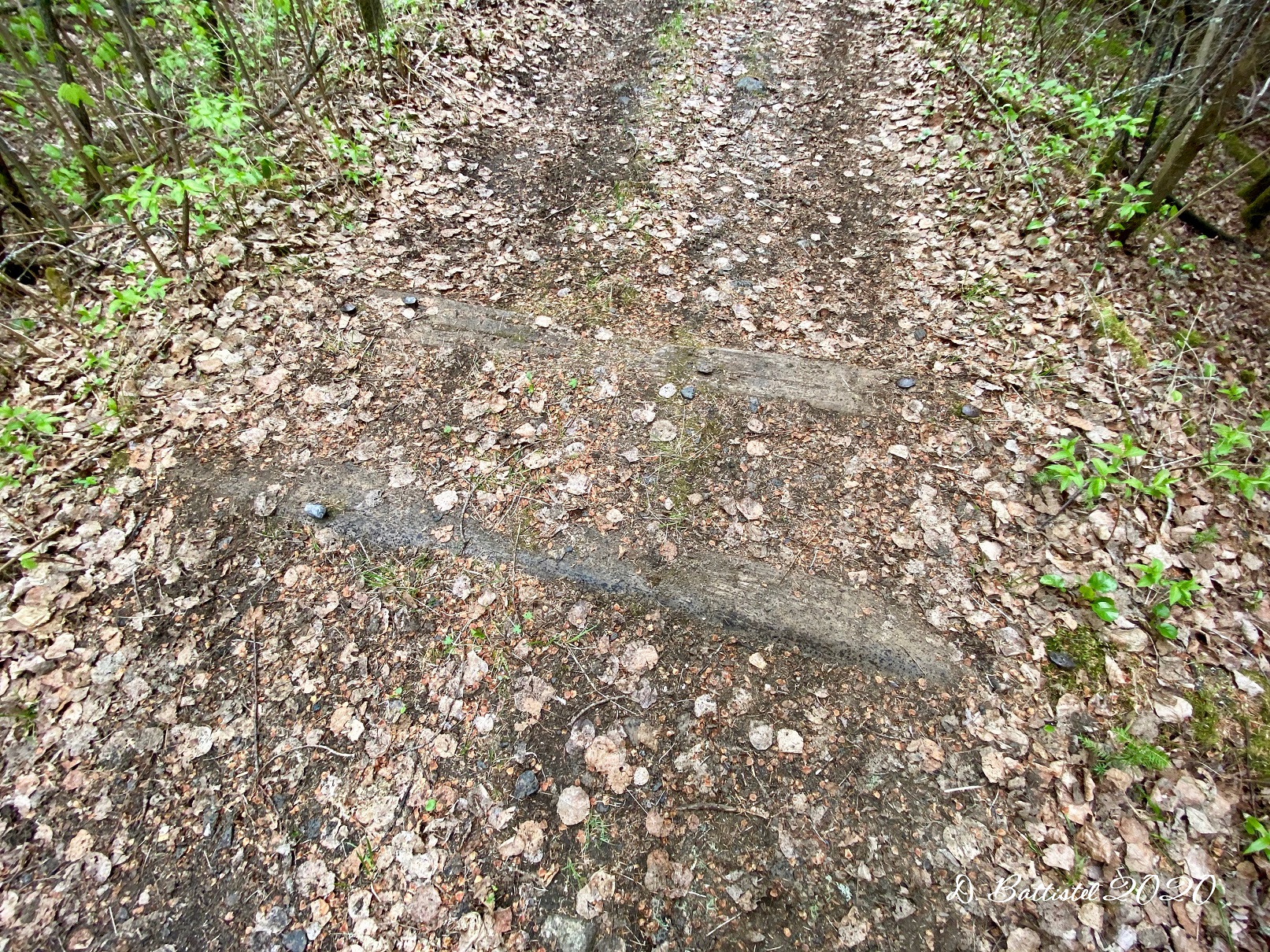
GTP Grade, May 2020.
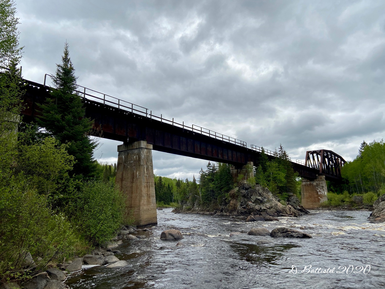
When Grand Trunk and Canadian Northern were merged to form Canadian National in the early 1920s, CN had some decisions to make in terms of its lines. In this case, they had two lines running in the same direction from Thunder Bay to this point. So, they decided to abandon 26 miles of the old GTP line, and had all westward trains use the Canadian Northern line to this point, which became known as Conmee Junction. The tracks to that point were doubled, and a new bridge built across the Matawin River. Some traffic would continue west on the Canadian Northern line, now known as the CN-Kashabowie Subdivision. The other would veer off the northwest, cross the new bridge and proceed to Sioux Lookout on the GTP line, which was now the Graham Subdivision. The Graham line stayed in operation until 1994 when was it was abandoned by CN.
I had been over the Matawin River bridge once before, shortly after the line was abandoned, around 1996. Fast forward 24 years and I found myself crossing the river again on that bridge. Let me preface this with the fact that I’m not good with heights, and walking across railway bridges isn’t easy as there’s not a solid deck, but rather large timbers spaced about 10 inches apart; it makes for an awkward walk. Plus, this bridge has been abandoned for 26 years, so the walkways on the sides are all rotten, so you need to walk down the middle of the bridge.
Anyway, ignoring the fact that I was 40 feet above the river, I walked across the 630-foot bridge to the other side. It didn’t really phase me at the time, maybe because I was so focused on taking pictures and video. The only time I really felt any fear was on my way back, video camera in hand and recording away, when one of those big bridge timbers wiggled a bit when I stepped on it. Talk about a disconcerting feeling! You are totally wrapped up in what you’re doing, one eye on the video camera and one eye on where your feet are going, when all of a sudden, your foot doesn’t plant properly. Now, it’s not like I was going to fall to my death or anything as the space between the timbers isn’t big enough to slip through. However, it does give you quite the mini heart attack! Other than that, maybe it was the adrenaline, I was fine, until I watched the video back. There were spots that made me feel nauseous and gave me a bit of vertigo. Maybe because I could see how high I was and that there were no railings. So weird!

Matawin River Bridge, May 2020.
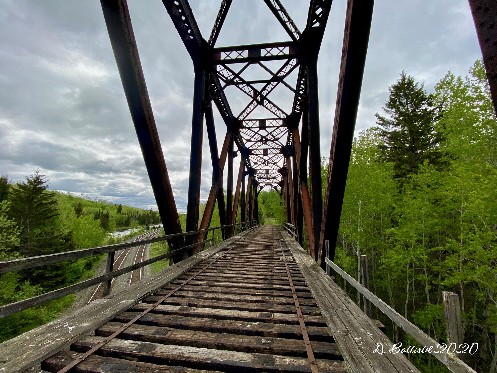
Matawin River Bridge, May 2020.
Matawin River Bridge, May 2020.

Matawin River Bridge, May 2020.

Matawin River Bridge, May 2020.
Matawin River Bridge, May 2020.

Matawin River Bridge, May 2020.

Matawin River Bridge, May 2020.
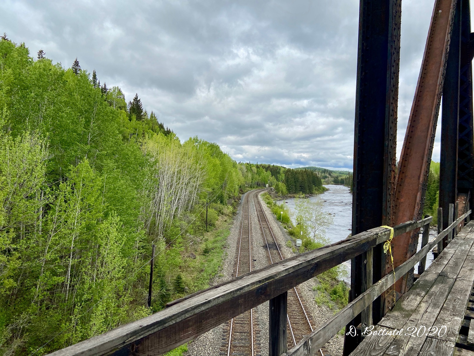
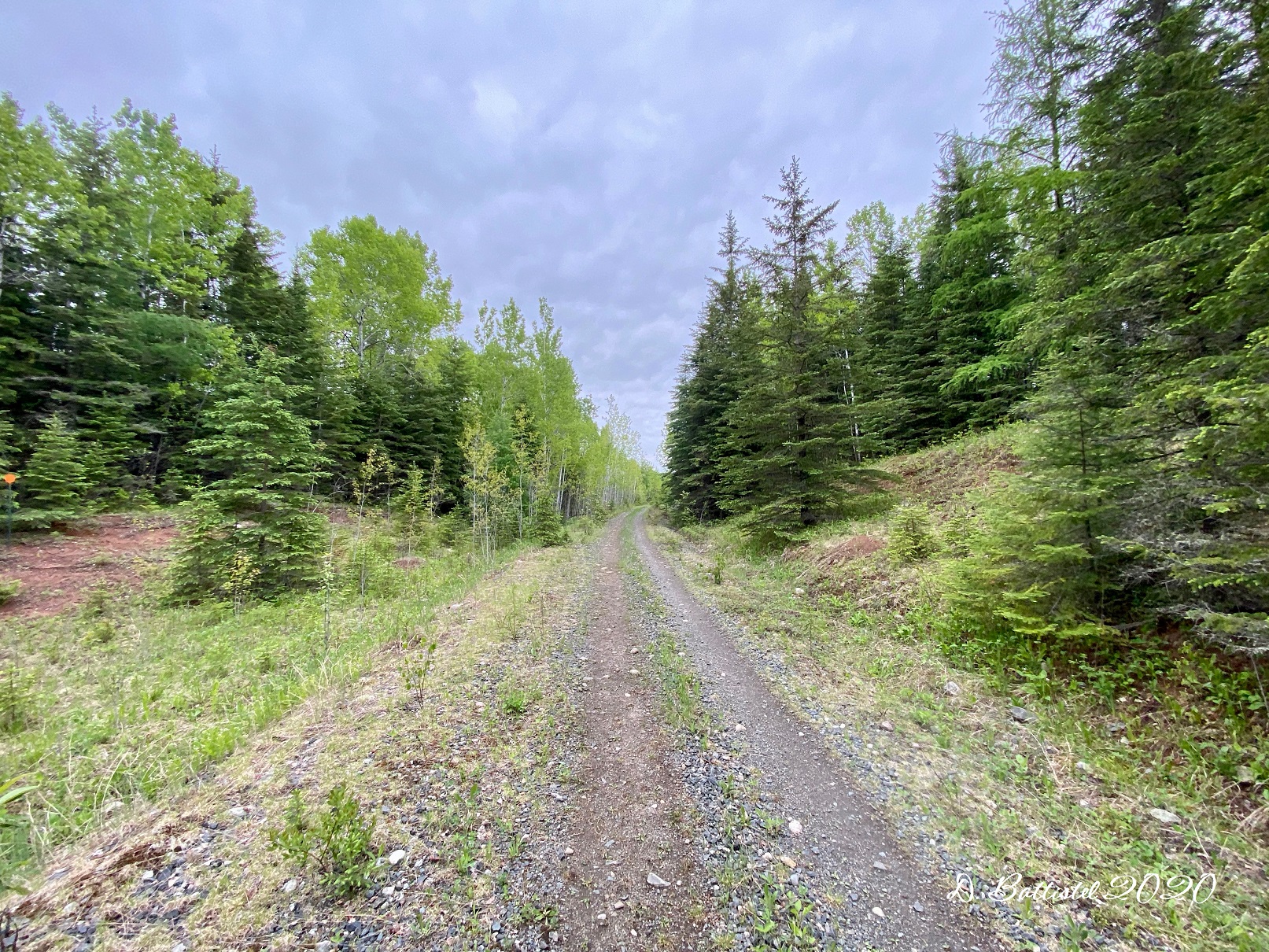
After shooting some pictures and video of the sides of the bridge, I turned my attention to the railway grade from the bridge back to where we had come in from, a road known as Sunshine Crossroads. The starting point is rather interesting, as it features unique junction. Here, the line from the bridge joins the old GTP lines and as you look east, you can see two grades; the newer one built by CN in 1924 and the original 1908 one built by GTP. From this point, it’s about 2.3km to Sunshine Crossroads, which I covered, as I have been doing recently, on my bike. It’s a nice area, but it has been wrecked in my opinion by logging that is going on alongside the grade. It’s kind of a shame. Anyway, you can watch the videos here.

GTP/CN Grade, May 2020.

GTP/CN Grade, May 2020.

GTP/CN Grade, May 2020.
A week or so later I was back to the same spot, this time pushing myself further westward along the railway. I typically like to do my hike n’ bikes (as I call them) backwards, that is start at my destination, go backwards to the starting point and then forwards again to the destination. This allows me to do all the hard work on the backward portion, such as taking pictures and logging GPS data. This then allows me to just focus on doing the video on the return leg.
So, on this hike, I began my journey at milepost 161.3, where the grade crosses Ellis Road. I would then work my way to milepost 164.5, where I left off on the previous hike at Sunshine Crossroads. This section of the GTP is a fairly easy stretch, and also passes by one of the stations known as Ellis at milepost 162.2. My journey did begin on a sour note though, as I realized, halfway through my drive to the area, that I forgot my hiking vest at home. I therefore had to improvise how I would carry my gear, which did make it a bit inconvenient. I managed though!
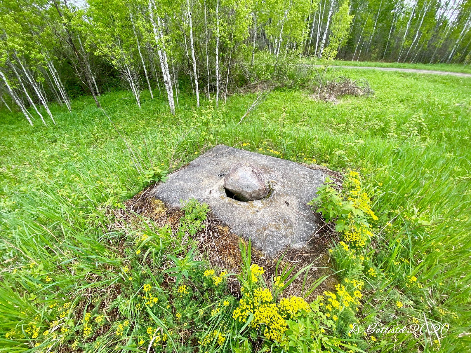
The hike went smoothly, though it did take longer than I expected. I found what I believed to be the location of Ellis Station, complete with the remains of the water tower. The only real shock I got was when I located another concrete culvert. I never really thought I’d find one so far west, my thinking that they were only built closer to Thunder Bay. This one was within a few hundred metres of the turnaround point at the Sunshine Crossroads, atop a very high embankment. I don’t think I’ve ever seen an embankment that high, as it was some 55 to 60 feet above the creek. I saw the creek and immediately my hopes went up and I quickly charged down the slope to investigate. From a distance I could make out the form of the concrete opening and instantly became giddy. The south side was okay, though I could not approach it closely as the water was very deep. The north side was a complete disaster; successive floods had pushed piles of debris in front of the opening and had exposed some twenty feet of the culvert by eroding the grade above it. It is beginning to come apart and crumble, but I guess it has been maintained in 26 years and was built in 1917. It’s to be expected.

GTP/CN Grade, June 2020.
GTP/CN Grade, June 2020.
GTP/CN Grade, June 2020.

GTP/CN Grade, June 2020.
This discovery has made me excited for future hikes along this line, and I’ve already started pinpointing creeks and streams via Google Earth to load into my GPS. Hopefully this will facilitate me in locating more of these concrete structures when I get to those locations.
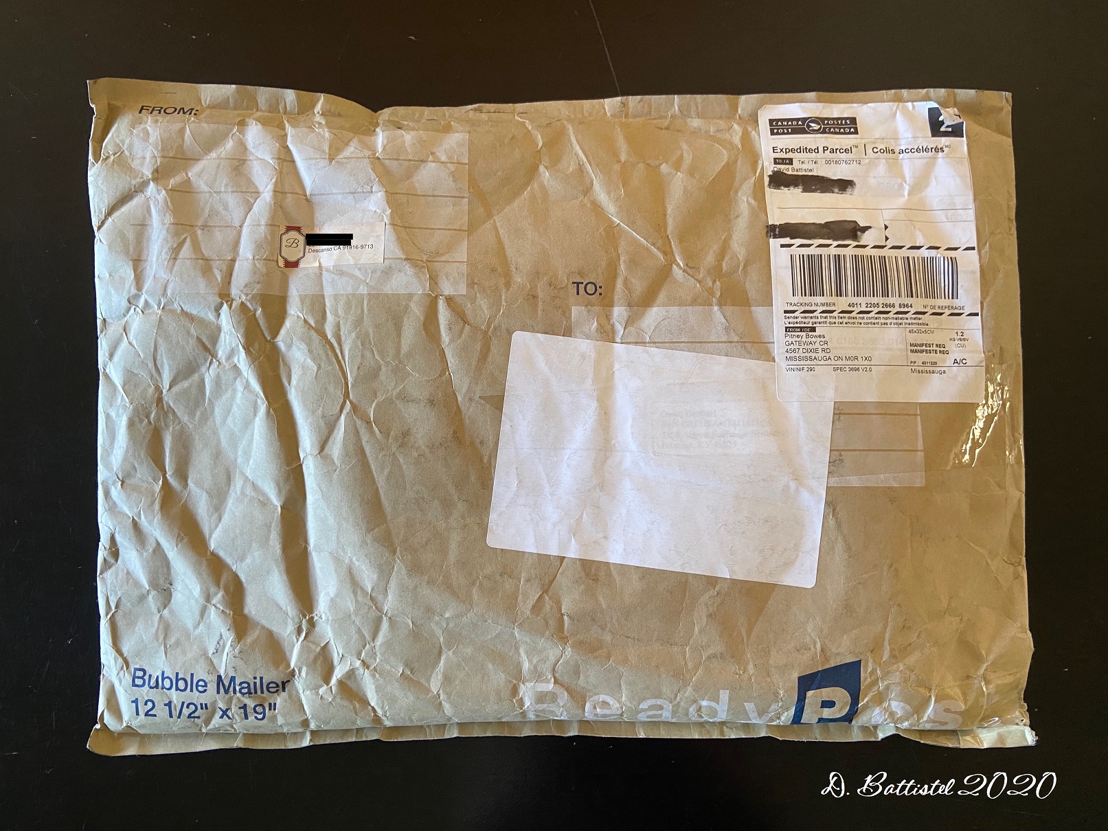
Okay, so I’ve saved my best news for last. If you read my last post I mentioned that I had something exciting coming in the mail; well, as you can imagine, it arrived last Thursday. Canada Post actually teased me a bit. Closely eyeing the tracking, Thursday morning it displayed that the package was “Out for Delivery.” Then suddenly, the message changed and the delivery was pushed back a day…so disappointing. However, at 4 o’clock I received a notification it was back out for delivery, which was weird to have something delivered that late in the day. Lo and behold, it showed up at 6:30!
Now, you’re probably wondering what the heck I got. Well, let me give you the whole story. I never go on ebay and I have not bought much off of that site in recent years. One day I was searching for railway timetables and I ended up there. What prompted me to search “Canadian Northern Railway” I’ll never know, but maybe it was fate. Anyway, this was one of the listings that came up: “You are bidding on almost two pounds’ worth of Canadian Northern Railway station paperwork circa 1912-1921. This assortment was salvaged in 1961 from behind an abandoned railroad station located on the Canadian-Minnesota boarder, not far from Gunflint Lake. (The paperwork had apparently been thrown out the back door and allowed to become humus after the rails were taken up.) This assortment includes shipping orders, Royal Mail reports, telegraph message blanks, custom manifests, collection deposit receipts, circular letters sent out by the passenger department, etc. The condition of these documents ranges from fair to something akin to the Dead Sea Scrolls. However, to the right person, they will be a treasure trove of historical railroad information from 100 years or so ago. We didn’t bother to count how many individual pieces are there, but it’s a lot. This assortment comes from a non-smoking household and will be shipped via USPS Retail Ground. It will undoubtedly be of interest to railroad museums and historians, authors, preservationists, and collectors of railroad paper. It’s been priced to sell so don’t let it get away from you because it slipped your mind to put in a bid. Our feedback rating speaks for itself so bid with confidence. Thanks for looking and GOOD LUCK BIDDING!”
After looking at the pictures, I was flabbergasted; it was unbelievable! It was an auction, but I knew I could not let this slip away. I immediately contacted the seller, told him my story and asked if I could make an offer on the item to buy it right away. He accepted and completed the transaction. It cost me a few bucks (the shipping was more than the papers) and my wife thought I was nuts, but you cannot put a price on this type of stuff (it was less than $100 Canadian). Afterwards, the seller contacted me and told me how he came to possess this paperwork. The story is just crazy and really makes me feel like I was destined to find this listing: “This paperwork was salvaged in the summer of 1961. We were on a Boy Scout canoe trip out of Gunflint Lake and happen to camp at the end of North Lake. Somehow, we stumbled upon the station which was then already hidden in the undergrowth. We discovered the paperwork in a heap behind the station. The top layers had probably already turned to humus, but we dug down and found some that was still reasonably intact. Without bothering to read through any of it, we scooped some of it up and packed it out with us. That was almost 60 years ago! After having it in storage for many years, I decided to list it on eBay. I’m DELIGHTED that you spotted it and that it will be going to someone who knows what it is and who can make some practical use of it.”
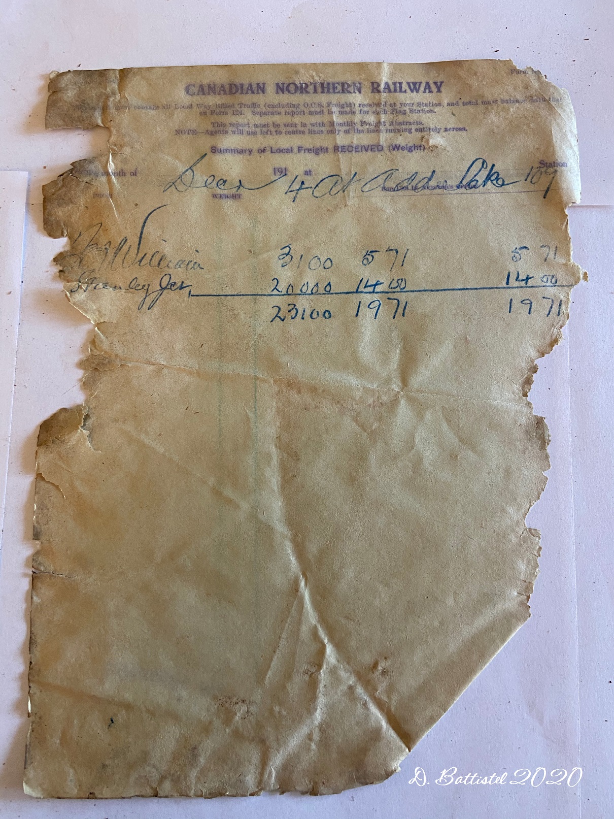
I was so excited to open the package and see what was inside. Turns out that about 60 to 65 percent of the material is useable historic documents, while the rest is just railway notices and forms. Some of the useable stuff is pure gold; there is one customs manifest of logs for the Pigeon River Lumber Company from 1908, while there are several customs reports of coal for the PRLC’s locomotives from 1906. There are many mail reports, as well as shipping forms for goods transported between Port Arthur and the various stations along the line. All told, the papers date from 1906 and 1922.
It took me several hours to separate the papers and photograph them all. Some are in good shape, while others, as the seller described, are like the Dead Sea Scrolls. There was a pile of dust and paper fragments left after I was done and certainly reinforced my belief that these documents now belong in a museum. I have reached out to the Thunder Bay Museum to have them take possession of them and see that they are properly preserved. I will keep you posted on how it goes.
North Lake Paperwork, June 2020.

North Lake Paperwork, June 2020.

North Lake Paperwork, June 2020.

North Lake Paperwork, June 2020.

North Lake Paperwork, June 2020.

North Lake Paperwork, June 2020.

North Lake Paperwork, June 2020.

North Lake Paperwork, June 2020.
North Lake Paperwork, June 2020.
Anyway, it’s time to move on. With school winding down I’ll have more time for hikes amongst other things, so I’ll be back before you know it with the latest news. Until then…

One response to “Man, that bridge was sketchy!”